|
search place name
|
||
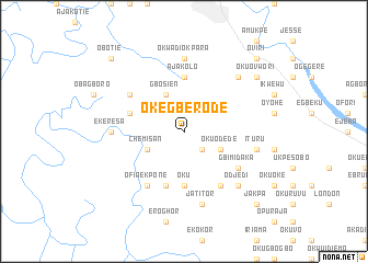
Okegberode (Gongola, Nigeria)Okegberode is a town in the Gongola region of Nigeria. An overview map of the region around Okegberode is displayed below.
regional and 3d topo map of Okegberode, Nigeria ::
Okegberode airports ::
The nearest airport is BNI - Benin, located 59.3 km north of Okegberode.
Other airports nearby include AKR - Akure (166.4 km north), PHC - Port Hartcourt Port Harcourt Intl (167.2 km south east), ENU - Enugu (225.0 km east), IBA - Ibadan (254.3 km north west), Nearby towns ::
Okuovu Inland (2.6km south east) //
Okuovu (2.6km south east) //
Okuodede (4.1km south east) //
Chemisan (4.1km south west) //
Gbosien (4.1km north west) //
Oku (5.6km south) //
Ajakolo (5.6km north) //
Elume (5.9km south) //
Ikeresa (5.8km west) //
Degbrode (6.7km south east) //
Gbimidaka (6.7km south east) //
Ofia Ekpone (6.7km south west) //
Gbukurusu (6.7km north west) //
Okwadiokpara (7.4km north) //
Ekeresa (7.4km west) //
Jatitor (7.6km south) //
Ituru (7.6km east) //
Amuegbedi (7.6km east) //
Odjedi (7.8km south east) //
Atakolo (7.8km north east) //
Okuovwori (9.2km north east) //
Jakpa (10.5km south east) //
Oviri (10.5km north east) //
Obotie (10.5km north west) //
[all distances 'as the bird flies' and approximate] 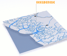 Places with similar names to Okegberode, Nigeria :: Disclaimer :: Information on this page comes without warranty of any kind |
||
|
Where is Okegberode? Elevation and coordinates ::
Latitude (lat): 5°47'0"N Longitude (lon): 5°39'0"E
Elevation (approx.): 8m (map arrows pan, magnifying glasses zoom) |
||
|
Visiting Okegberode? Hotel/Accommodation ::
Book a hotel in Okegberode Travel Guide ::
Buy a travel guide for Nigeria rental cars ::
car rental offers GPS waypoint ::
download a GPX waypoint (PoI) of Okegberode for your GPS receiver
|
||