|
search place name
|
||
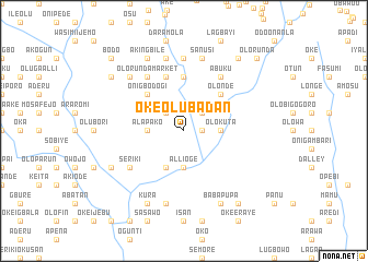
Oke Olubadan (Gongola, Nigeria)Oke Olubadan is a town in the Gongola region of Nigeria. An overview map of the region around Oke Olubadan is displayed below.
regional and 3d topo map of Oke Olubadan, Nigeria ::
Oke Olubadan airports ::
The nearest airport is IBA - Ibadan, located 31.9 km north east of Oke Olubadan.
Other airports nearby include LOS - Lagos Murtala Muhammed (81.4 km south west), ILR - Ilorin (162.8 km north east), AKR - Akure (168.0 km east), COO - Cotonou Cadjehoun (177.8 km south west), Nearby towns ::
Ogunmakin (1.8km east) //
Imolisa (2.6km north west) //
Alaho (2.6km north east) //
Alapako (3.7km west) //
Alli Oge (3.7km south) //
Olokuta (3.7km east) //
Lemomu (4.1km south west) //
Onigbodogi (5.2km north west) //
Akorodu (5.2km north east) //
Abukun (5.2km north east) //
Olonde (5.2km north east) //
Deyiola (5.6km north) //
Bankole (5.9km north) //
Akindele (6.7km north west) //
Elesin (6.7km north west) //
Olorunda Market (6.7km north west) //
Debonre (6.6km south west) //
Seriki (6.6km south west) //
Abuku (6.7km north east) //
Awulogun (7.4km north) //
Oluwo (7.6km north) //
Ekuku (7.6km south) //
Sanusi (7.6km north) //
Bamgboye (7.8km north west) //
Ajebo (8.2km south west) //
Akingbile (8.3km north west) //
Kura (8.3km south west) //
Akofa (8.3km south east) //
Babapupa (8.3km south east) //
[all distances 'as the bird flies' and approximate] 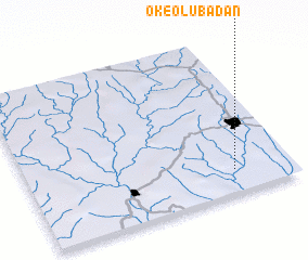 Places with similar names to Oke Olubadan, Nigeria :: Disclaimer :: Information on this page comes without warranty of any kind |
||
|
Where is Oke Olubadan? Elevation and coordinates ::
Latitude (lat): 7°9'0"N Longitude (lon): 3°47'0"E
Elevation (approx.): 102m (map arrows pan, magnifying glasses zoom) |
||
|
Visiting Oke Olubadan? Hotel/Accommodation ::
Book a hotel in Oke Olubadan Travel Guide ::
Buy a travel guide for Nigeria rental cars ::
car rental offers GPS waypoint ::
download a GPX waypoint (PoI) of Oke Olubadan for your GPS receiver
|
||