|
search place name
|
||
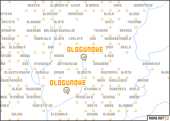
Ologun Owe (Gongola, Nigeria)Ologun Owe is a town in the Gongola region of Nigeria. An overview map of the region around Ologun Owe is displayed below.
regional and 3d topo map of Ologun Owe, Nigeria ::
Ologun Owe airports ::
The nearest airport is IBA - Ibadan, located 60.8 km east of Ologun Owe.
Other airports nearby include LOS - Lagos Murtala Muhammed (110.6 km south), ILR - Ilorin (148.9 km north east), COO - Cotonou Cadjehoun (179.4 km south west), AKR - Akure (205.6 km east), Nearby towns ::
Adiyere (1.8km east) //
Iberekodo (1.9km south) //
Alapata (2.6km north east) //
Eruwa Titun (2.6km south west) //
Olokete (3.7km south) //
Erin Aboro (4.1km north east) //
Lala (4.1km north east) //
Awawu (4.1km north east) //
Ago (4.1km north east) //
Onigbana (4.1km south east) //
Lanlate (4.1km north west) //
Ofe (4.1km south east) //
Orita Eruwa (4.1km south west) //
Fagbola (5.2km south east) //
Ilado (5.5km east) //
Baba Ode (5.6km south) //
Elewu Nla (5.6km south) //
Agasa (5.5km west) //
Olaniyan (5.9km south) //
Erin (5.8km east) //
Asako (5.9km north) //
Alayande (5.9km south) //
Saka (6.7km south east) //
Bara (6.7km south east) //
Abule Eruwa (6.6km north east) //
Temidire (6.7km north east) //
Oloko (6.6km north west) //
Aderonmu (6.6km south east) //
Adeleye (6.6km south east) //
[all distances 'as the bird flies' and approximate]  Places with similar names to Ologun Owe, Nigeria ::
// Ologun Owe (NG)
Disclaimer :: Information on this page comes without warranty of any kind |
||
|
Where is Ologun Owe? Elevation and coordinates ::
Latitude (lat): 7°34'0"N Longitude (lon): 3°28'0"E
Elevation (approx.): 185m (map arrows pan, magnifying glasses zoom) |
||
|
Visiting Ologun Owe? Hotel/Accommodation ::
Book a hotel in Ologun Owe Travel Guide ::
Buy a travel guide for Nigeria rental cars ::
car rental offers GPS waypoint ::
download a GPX waypoint (PoI) of Ologun Owe for your GPS receiver
|
||