|
search place name
|
||
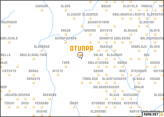
Otunpa (Gongola, Nigeria)Otunpa is a town in the Gongola region of Nigeria. An overview map of the region around Otunpa is displayed below.
regional and 3d topo map of Otunpa, Nigeria ::
Otunpa airports ::
The nearest airport is IBA - Ibadan, located 82.3 km east of Otunpa.
Other airports nearby include LOS - Lagos Murtala Muhammed (111.4 km south), ILR - Ilorin (165.2 km north east), COO - Cotonou Cadjehoun (167.0 km south west), Nearby towns ::
Ayanyemi (2.6km north east) //
Alalubosa (2.6km north east) //
Elewure (2.6km north east) //
Salau (3.7km east) //
Onileka (4.1km south east) //
Ogundiya (4.1km south east) //
Abiluyungba (4.1km south east) //
Olowolaiyemo (4.1km south east) //
Ewedeyi (4.1km north east) //
Tapa (4.1km south west) //
Giwa Elewure (4.1km north east) //
Sonpa (5.2km south east) //
Lawani Alalubosa (5.2km north east) //
Oniwafin Tapa (5.2km north west) //
Okekunle (5.5km east) //
Afefu (5.6km south) //
Kondo (5.5km east) //
Tobalogo (5.9km south) //
Ola (5.8km east) //
Balogun (5.8km east) //
Apenpe (5.9km north) //
Alagba (5.8km east) //
Ajibi (5.8km east) //
Adedijo (5.8km east) //
Olukotun (6.7km south east) //
Kura (6.6km south east) //
Aiyete (6.6km south west) //
Olurin (6.6km south east) //
Oniwafin (6.6km north east) //
[all distances 'as the bird flies' and approximate]  Places with similar names to Otunpa, Nigeria ::
Disclaimer :: Information on this page comes without warranty of any kind |
||
|
Where is Otunpa? Elevation and coordinates ::
Latitude (lat): 7°35'0"N Longitude (lon): 3°16'0"E
Elevation (approx.): 158m (map arrows pan, magnifying glasses zoom) |
||
|
Visiting Otunpa? Hotel/Accommodation ::
Book a hotel in Otunpa Travel Guide ::
Buy a travel guide for Nigeria rental cars ::
car rental offers GPS waypoint ::
download a GPX waypoint (PoI) of Otunpa for your GPS receiver
|
||