|
search place name
|
||
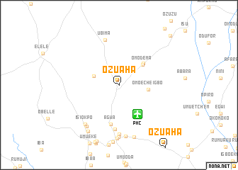
Ozuaha (Nigeria)Ozuaha is a town in Nigeria. An overview map of the region around Ozuaha is displayed below.
regional and 3d topo map of Ozuaha, Nigeria ::
Ozuaha airports ::
The nearest airport is PHC - Port Hartcourt Port Harcourt Intl, located 5.5 km south east of Ozuaha.
Other airports nearby include CBQ - Calabar (158.2 km east), ENU - Enugu (172.0 km north east), BNI - Benin (202.2 km north west), SSG - Malabo (245.0 km south east), Nearby towns ::
Omo Nwa (4.2km west) //
Omoecheigbo (4.7km east) //
Omodema (4.9km north east) //
Elelele (5.2km north east) //
Agwa (6.3km south) //
Umu-Ogwu (7.0km south) //
Ubima (7.4km north) //
Umu-Olo (7.7km south) //
Umu-Eket (8.1km south) //
Isiokpo (8.1km south west) //
Agwa (8.2km south) //
Alumiri-Isiokpo (8.2km south west) //
Umu-Eketu (8.5km south) //
Imogwu-Agwa (8.6km south) //
Umuperepe (8.8km south west) //
Nkarahia (9.5km south) //
Obukwu (11.2km north east) //
Obono (11.4km north east) //
[all distances 'as the bird flies' and approximate] 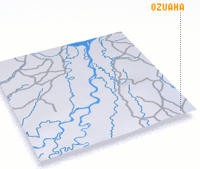
Disclaimer :: Information on this page comes without warranty of any kind |
||
|
Where is Ozuaha? Elevation and coordinates ::
Latitude (lat): 5°3'25"N Longitude (lon): 6°55'21"E
Elevation (approx.): 36m (map arrows pan, magnifying glasses zoom) |
||
|
Visiting Ozuaha? Hotel/Accommodation ::
Book a hotel in Ozuaha Travel Guide ::
Buy a travel guide for Nigeria rental cars ::
car rental offers GPS waypoint ::
download a GPX waypoint (PoI) of Ozuaha for your GPS receiver
|
||