|
search place name
|
||
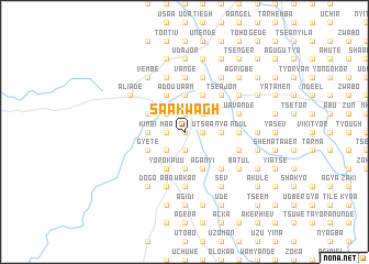
Saakwagh (Gongola, Nigeria)Saakwagh is a town in the Gongola region of Nigeria. An overview map of the region around Saakwagh is displayed below.
regional and 3d topo map of Saakwagh, Nigeria ::
Saakwagh airports ::
The nearest airport is MDI - Makurdi, located 49.2 km north of Saakwagh.
Other airports nearby include ENU - Enugu (138.6 km south west), BPC - Bamenda (222.1 km south east), ABV - Abuja Nnamdi Azikiwe Intl (238.0 km north west), BFX - Bafoussam (277.8 km south east), Nearby towns ::
Chokom (0.0km north) //
Abar (1.9km north) //
Dongko (1.9km north) //
Mbabende (1.9km north) //
Numiwa (1.9km north) //
Maa (1.8km west) //
Akanjor (1.8km west) //
Akaazar (1.8km west) //
Adoka (1.8km west) //
Kyo (1.9km south) //
Kyovor (1.8km east) //
Akume (1.8km east) //
Twel (1.8km east) //
Bughta (1.9km south) //
Dyuu (1.8km east) //
Nongu (1.8km east) //
Nyamvior (1.8km east) //
Shakwa (1.9km south) //
Utsaa (1.8km east) //
Ayamfaga (1.8km east) //
Kutsuku (1.8km east) //
Yari (2.6km north west) //
Vange (2.6km north west) //
Tiav (2.6km north west) //
Nakwase (2.6km north west) //
Haruna (2.6km north west) //
Manta (2.6km north west) //
Awajir (2.6km north east) //
Twor Awajir (2.6km south west) //
[all distances 'as the bird flies' and approximate] 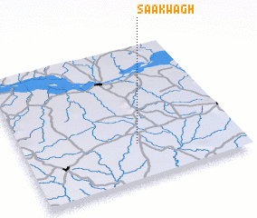 Places with similar names to Saakwagh, Nigeria :: Disclaimer :: Information on this page comes without warranty of any kind |
||
|
Where is Saakwagh? Elevation and coordinates ::
Latitude (lat): 7°16'0"N Longitude (lon): 8°32'0"E
Elevation (approx.): 183m (map arrows pan, magnifying glasses zoom) |
||
|
Visiting Saakwagh? Hotel/Accommodation ::
Book a hotel in Saakwagh Travel Guide ::
Buy a travel guide for Nigeria rental cars ::
car rental offers GPS waypoint ::
download a GPX waypoint (PoI) of Saakwagh for your GPS receiver
|
||