|
search place name
|
||
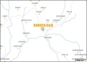
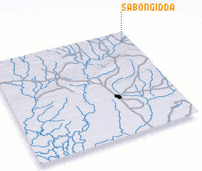
Sabongidda (Gongola, Nigeria)Sabongidda is a town in the Gongola region of Nigeria. An overview map of the region around Sabongidda is displayed below.
regional and 3d topo map of Sabongidda, Nigeria ::
Sabongidda airports ::
The nearest airport is BNI - Benin, located 74.3 km south west of Sabongidda.
Other airports nearby include AKR - Akure (79.7 km north west), ENU - Enugu (186.1 km east), IBA - Ibadan (221.9 km west), ILR - Ilorin (232.9 km north west), Nearby towns ::
 Places with similar names to Sabongidda, Nigeria ::
// Sabon Gida (GH)
// Sabon Gida (NG)
// Sabon Gida (NG)
// Sabon Gida (NG)
// Sabon Gida (NG)
// Sabon Gida (NG)
// Sabon Gida (NG)
// Sabon Gida (NG)
// Sabon Gida (NG)
// Sabon Gida (NG)
Disclaimer :: Information on this page comes without warranty of any kind |
||
|
Where is Sabongidda? Elevation and coordinates ::
Latitude (lat): 6°54'0"N Longitude (lon): 5°56'0"E
Elevation (approx.): 76m (map arrows pan, magnifying glasses zoom) |
||
|
Visiting Sabongidda? Hotel/Accommodation ::
Book a hotel in Sabongidda Travel Guide ::
Buy a travel guide for Nigeria rental cars ::
car rental offers GPS waypoint ::
download a GPX waypoint (PoI) of Sabongidda for your GPS receiver
|
||