|
search place name
|
||
Salahawo (Gongola, Nigeria)Salahawo is a town in the Gongola region of Nigeria. An overview map of the region around Salahawo is displayed below.
regional and 3d topo map of Salahawo, Nigeria ::

Salahawo airports ::
The nearest airport is ZAR - Zaria, located 78.9 km south of Salahawo.
Other airports nearby include QUS - Gusau (101.9 km west), KAN - Kano Mallam Aminu Intl (107.0 km east), KAD - Kaduna (128.7 km south), MFG - Maradi (190.7 km north), Nearby towns ::
Yaba (1.9km south) //
Kutosheka (1.8km east) //
Almajirawa (1.9km north) //
Hayi (3.7km south) //
Leggere (3.7km north) //
Ungwan Sarkin Dangi (3.6km west) //
Tsamiyan Gude (4.1km south east) //
Marmara (4.1km south west) //
Ungwan Adada (4.1km north east) //
Kadayan Nagora (4.1km north west) //
Ginnery (5.2km south east) //
Ungwan Dutsi (5.2km south east) //
Kwasu Maguzawa (5.2km south east) //
Borin Dawa (5.4km east) //
Tsaunin Goge (5.7km west) //
Furiya (5.8km north) //
Dorawan Natiba (5.7km west) //
Mashiji (5.7km east) //
Layin Barayu (6.6km south east) //
Malumfashi (6.6km south east) //
Agangaro (6.6km south west) //
Wanzamai (7.4km south) //
Badau (7.4km north) //
Sabon Layi (9.2km south east) //
Kauyan Dawo (9.2km south east) //
Ungwan Yaro (9.2km south east) //
Ungwan Ganga (10.4km south east) //
Girbobo (10.4km north east) //
[all distances 'as the bird flies' and approximate] 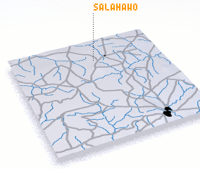
Disclaimer :: Information on this page comes without warranty of any kind |
||
|
Where is Salahawo? Elevation and coordinates ::
Latitude (lat): 11°50'0"N Longitude (lon): 7°34'0"E
Elevation (approx.): 612m (map arrows pan, magnifying glasses zoom) |
||
|
Visiting Salahawo? Hotel/Accommodation ::
Book a hotel in Salahawo Travel Guide ::
Buy a travel guide for Nigeria rental cars ::
car rental offers GPS waypoint ::
download a GPX waypoint (PoI) of Salahawo for your GPS receiver
|
||