|
search place name
|
||
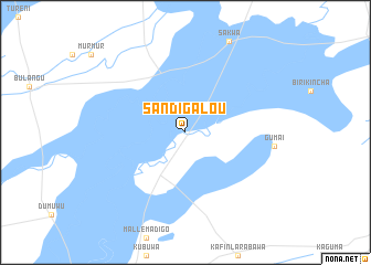
Sandigalou (Bauchi, Nigeria)Sandigalou is a town in the Bauchi region of Nigeria. An overview map of the region around Sandigalou is displayed below.
regional and 3d topo map of Sandigalou, Nigeria ::
Sandigalou airports ::
The nearest airport is KAN - Kano Mallam Aminu Intl, located 188.1 km west of Sandigalou.
Other airports nearby include ZND - Zinder (236.1 km north west), Nearby towns ::
[all distances 'as the bird flies' and approximate] 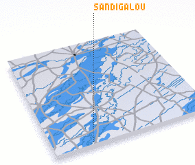 Places with similar names to Sandigalou, Nigeria ::
// Sandıklı (TR)
// Şandūqlū (IR)
// Zandai Kili (PK)
// Sandia Kolé (GN)
// Santiguila (GN)
// Soundougoula (GN)
// Sandae-gol (KP)
// Sandu-gol (KP)
// Sŏndo-gol (KP)
// Sandy Gully (JM)
Disclaimer :: Information on this page comes without warranty of any kind |
||
|
Where is Sandigalou? Elevation and coordinates ::
Latitude (lat): 12°2'44"N Longitude (lon): 10°15'9"E
Elevation (approx.): 370m (map arrows pan, magnifying glasses zoom) |
||
|
Visiting Sandigalou? Hotel/Accommodation ::
Book a hotel in Sandigalou Travel Guide ::
Buy a travel guide for Nigeria rental cars ::
car rental offers GPS waypoint ::
download a GPX waypoint (PoI) of Sandigalou for your GPS receiver
|
||