|
search place name
|
||
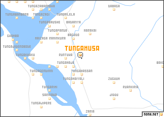
Tunga Musa (Gongola, Nigeria)Tunga Musa is a town in the Gongola region of Nigeria. An overview map of the region around Tunga Musa is displayed below.
regional and 3d topo map of Tunga Musa, Nigeria ::
Tunga Musa airports ::
The nearest airport is SKO - Sokoto Sadiq Abubakar Iii Intl, located 200.6 km north east of Tunga Musa.
Nearby towns ::
Tunga Ulu (2.6km north west) //
Kashin Giwa (2.6km north west) //
Futawa (2.6km north east) //
Tunga Hakimi Isa (2.6km south west) //
Runtuwa (3.6km west) //
Tunga Hassan (3.7km south) //
Tunga Maje (4.1km south west) //
Tunga Alhaji (4.1km south west) //
Bagudo (4.9km north) //
Tunga Buzaye (5.6km south) //
Tunga Maiyali (5.8km south) //
Tuluwa (5.8km west) //
Marakai (5.8km north) //
Ramin Kura (6.6km north west) //
Badariya (7.6km north) //
Tunga Bombo (7.5km west) //
Tunga Farda (7.8km north west) //
Zuguum (9.2km south east) //
Tunga Baushe (10.4km north west) //
Tunga Rimi (10.4km south west) //
[all distances 'as the bird flies' and approximate] 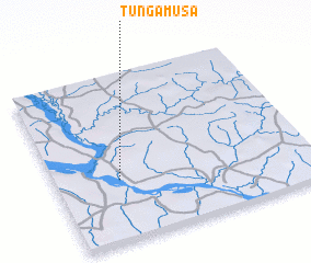 Places with similar names to Tunga Musa, Nigeria ::
// Tangmas (ID)
// Dan Koumissi (NE)
// Tunga Masu (NG)
// Dongamissa (MZ)
// Taongomos (PH)
// Tangoumassou (CI)
Disclaimer :: Information on this page comes without warranty of any kind |
||
|
Where is Tunga Musa? Elevation and coordinates ::
Latitude (lat): 11°22'0"N Longitude (lon): 4°15'0"E
Elevation (approx.): 156m (map arrows pan, magnifying glasses zoom) |
||
|
Visiting Tunga Musa? Hotel/Accommodation ::
Book a hotel in Tunga Musa Travel Guide ::
Buy a travel guide for Nigeria rental cars ::
car rental offers GPS waypoint ::
download a GPX waypoint (PoI) of Tunga Musa for your GPS receiver
|
||