|
search place name
|
||
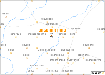
Unguwar Taro (Gongola, Nigeria)Unguwar Taro is a town in the Gongola region of Nigeria. An overview map of the region around Unguwar Taro is displayed below.
regional and 3d topo map of Unguwar Taro, Nigeria ::
Unguwar Taro airports ::
The nearest airport is MXJ - Minna New, located 96.2 km south of Unguwar Taro.
Other airports nearby include KAD - Kaduna (106.2 km east), ZAR - Zaria (159.4 km north east), QUS - Gusau (186.6 km north), ABV - Abuja Nnamdi Azikiwe Intl (193.8 km south east), Nearby towns ::
Ganong Gari (3.7km north) //
Kashua (3.6km east) //
Unguwar Namanda (5.5km west) //
Gidan Maigari Boka (5.9km south) //
Tudun Raha (5.9km north) //
Gidan Bagudu (6.6km south west) //
Zara (7.3km east) //
Gidan Maizaji (7.6km south) //
Dawakin Bassa (7.8km north west) //
Gidan Buhari (7.8km south east) //
Kusheriki (8.6km east) //
Gidan Maikarfi (9.2km south east) //
Gidan Kurao (9.2km south east) //
[all distances 'as the bird flies' and approximate] 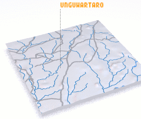 Places with similar names to Unguwar Taro, Nigeria ::
// Unguwar Turai (NG)
Disclaimer :: Information on this page comes without warranty of any kind |
||
|
Where is Unguwar Taro? Elevation and coordinates ::
Latitude (lat): 10°31'0"N Longitude (lon): 6°22'0"E
Elevation (approx.): 399m (map arrows pan, magnifying glasses zoom) |
||
|
Visiting Unguwar Taro? Hotel/Accommodation ::
Book a hotel in Unguwar Taro Travel Guide ::
Buy a travel guide for Nigeria rental cars ::
car rental offers GPS waypoint ::
download a GPX waypoint (PoI) of Unguwar Taro for your GPS receiver
|
||