|
search place name
|
||
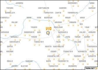
Vio (Gongola, Nigeria)Vio is a town in the Gongola region of Nigeria. An overview map of the region around Vio is displayed below.
regional and 3d topo map of Vio, Nigeria ::
Vio airports ::
The nearest airport is YOL - Yola, located 151.5 km south of Vio.
Other airports nearby include MIU - Maiduguri (178.0 km north east), GOU - Garoua (197.3 km south east), Nearby towns ::
Bum (2.6km north east) //
Dam (3.6km west) //
Kilbula (3.6km east) //
Kumba (4.1km south west) //
Kwadiga (4.1km north west) //
Bila (4.1km south east) //
Zar (4.1km south east) //
Pakilsha (4.1km north east) //
Tsahuyam (5.2km south west) //
Taza (5.2km south east) //
Kirbola (5.2km south east) //
Tum (5.2km north east) //
Wakama (5.2km north east) //
Mainta (5.6km south) //
Barawe (5.5km east) //
Sungdung (5.5km east) //
Burakum (5.6km north) //
Melala (5.8km west) //
Tasha (5.8km west) //
Lugshari (5.8km east) //
Lakeri (5.8km west) //
Yederi (5.8km west) //
Manda Klihilba (5.8km east) //
Bula (5.9km north) //
Birni (6.6km south west) //
Morom (6.6km south east) //
Vina (6.6km north west) //
Kwaya Bura (6.6km south east) //
Gurum (7.3km west) //
[all distances 'as the bird flies' and approximate] 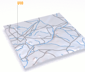 Places with similar names to Vio, Nigeria ::
Disclaimer :: Information on this page comes without warranty of any kind |
||
|
Where is Vio? Elevation and coordinates ::
Latitude (lat): 10°35'0"N Longitude (lon): 12°5'0"E
Elevation (approx.): 661m (map arrows pan, magnifying glasses zoom) |
||
|
Visiting Vio? Hotel/Accommodation ::
Book a hotel in Vio Travel Guide ::
Buy a travel guide for Nigeria rental cars ::
car rental offers GPS waypoint ::
download a GPX waypoint (PoI) of Vio for your GPS receiver
|
||