|
search place name
|
||
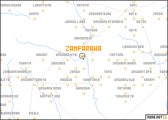
Zamfarawa (Gongola, Nigeria)Zamfarawa is a town in the Gongola region of Nigeria. An overview map of the region around Zamfarawa is displayed below.
regional and 3d topo map of Zamfarawa, Nigeria ::
Zamfarawa airports ::
The nearest airport is KAN - Kano Mallam Aminu Intl, located 77.8 km east of Zamfarawa.
Other airports nearby include ZAR - Zaria (78.0 km south), QUS - Gusau (131.7 km west), KAD - Kaduna (136.8 km south west), MFG - Maradi (202.4 km north west), Nearby towns ::
Kumbawa (1.8km east) //
Kwari (1.9km south) //
Jamaa (1.8km east) //
Malamawa (2.6km north east) //
Yan Rawa (2.6km north east) //
Tagwayan Marke (2.6km south west) //
Barakai (2.6km south west) //
Makauraci (3.7km north) //
Ungwan Dutsi (3.6km west) //
Zango (4.1km south west) //
Jan Kyankyan (4.1km south east) //
Badawa (5.2km south west) //
Jan Kyankyan (5.2km south east) //
Badari (5.4km east) //
Ungwan Gari (5.7km west) //
Kutama (5.8km north) //
Gamzago (5.7km west) //
Dankanjiba (5.8km south) //
Kwanyawa (5.8km south) //
Magaje (6.6km south west) //
Gorawa (6.6km south east) //
Tofa (6.6km south east) //
Parindaso (7.4km north) //
Dan Kowa (7.4km south) //
Yan Turu (7.3km east) //
Bauda (7.6km north) //
Jankollawa (7.6km north) //
Ungwan Katsinawa (9.2km north east) //
Ungwan Korau (10.4km south west) //
[all distances 'as the bird flies' and approximate] 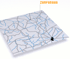 Places with similar names to Zamfarawa, Nigeria ::
// Zamfarawa (NG)
Disclaimer :: Information on this page comes without warranty of any kind |
||
|
Where is Zamfarawa? Elevation and coordinates ::
Latitude (lat): 11°49'0"N Longitude (lon): 7°51'0"E
Elevation (approx.): 562m (map arrows pan, magnifying glasses zoom) |
||
|
Visiting Zamfarawa? Hotel/Accommodation ::
Book a hotel in Zamfarawa Travel Guide ::
Buy a travel guide for Nigeria rental cars ::
car rental offers GPS waypoint ::
download a GPX waypoint (PoI) of Zamfarawa for your GPS receiver
|
||