|
search place name
|
||
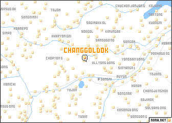
Changgoldŏk (Hamgyŏng, Korea, North)Changgoldŏk is a town in the Hamgyŏng region of Korea, North. An overview map of the region around Changgoldŏk is displayed below.
regional and 3d topo map of Changgoldŏk, Korea, North ::
Nearby towns ::
Changkoldŏk (0.4km west) //
Hayŏn-dong (2.0km north east) //
Yongman (2.1km north east) //
Sangyŏn-dong (1.9km north east) //
Ch'angjin'gae (2.2km north west) //
Chungp'yŏng-dong (2.6km south) //
Yongyangdongsunam (2.6km north) //
Sangp'yŏng-dong (3.0km south) //
Irhyang-dong (2.6km south west) //
Kŭktong-nodongjagu (3.2km south) //
Yongyangdongsubuk (3.2km north west) //
Namyang-dong (3.6km north) //
Tonae (3.7km south west) //
Namyang (3.0km west) //
Sinch'ang-dong (4.0km south) //
Panggumi (4.0km south) //
Ullyong-dong (3.3km south east) //
Hŭngch'ogae (4.0km north east) //
Yonggoch'i (3.7km north east) //
Kwangsang-dong (3.8km south east) //
Kyŏngam-dong (3.8km south east) //
Toryongbong (4.3km north west) //
Nosang-dong (3.6km east) //
Yongsan (4.2km north west) //
Wadŏk (4.1km south west) //
Hwasŏng-ŭp (4.4km south west) //
Chinbong (4.1km west) //
Myosan (5.4km south) //
Soegol (5.4km north) //
[all distances 'as the bird flies' and approximate] 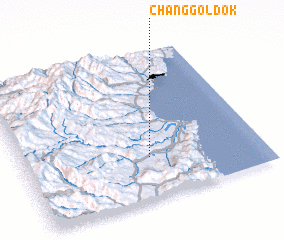 Places with similar names to Changgoldŏk, Korea, North :: Disclaimer :: Information on this page comes without warranty of any kind |
||
|
Where is Changgoldŏk? Elevation and coordinates ::
Latitude (lat): 41°17'5"N Longitude (lon): 129°31'42"E
Elevation (approx.): 200m (map arrows pan, magnifying glasses zoom) |
||
|
Visiting Changgoldŏk? Hotel/Accommodation ::
Book a hotel in Changgoldŏk Travel Guide ::
rental cars ::
car rental offers GPS waypoint ::
download a GPX waypoint (PoI) of Changgoldŏk for your GPS receiver
|
||