|
search place name
|
||
Chisŏng-ni (Kangwŏn, Korea, North)Chisŏng-ni is a town in the Kangwŏn region of Korea, North. An overview map of the region around Chisŏng-ni is displayed below.
regional and 3d topo map of Chisŏng-ni, Korea, North ::

Chisŏng-ni airports ::
The nearest airport is SHO - Sokch'o Sokcho, located 89.1 km south east of Chisŏng-ni.
Other airports nearby include SSN - Seoul East Seoul Ab (139.2 km south west), KAG - Kangnung Gangneung (139.8 km south east), GMP - Seoul Gimpo (142.6 km south west), OSN - Osan Ab (178.5 km south), Nearby towns ::
Sangjisŏng-ni (0.9km north west) //
Hajisŏng-ni (1.1km south) //
Piyang-dong (2.2km south) //
Tokku-ri (2.9km north) //
Ansojae (3.2km west) //
Songp'o-ri (3.5km west) //
Nŭngdong-ni (4.8km south) //
Sinsŏng-ni (4.8km south east) //
Sadong-ni (4.3km north east) //
Kwal-li (5.4km north west) //
Sŏngdo-ri (5.0km south west) //
Simp'o-ri (4.9km north west) //
Sangyangji (4.7km east) //
Hoedong-ni (4.9km east) //
Sinansang-ni (5.6km north west) //
Sŏnghyŏn-ni (5.8km south west) //
Hoejŏn-dong (6.5km north) //
Kisŏng-ni (6.5km south) //
Kaemal-li (5.5km north west) //
Sangguman-ni (6.0km north east) //
Sinanjung-ni (6.5km north west) //
Sangsadon-ni (5.5km east) //
Hakumal-li (5.8km north east) //
Kŭmsal-li (5.9km north east) //
Sango-ri (6.3km south west) //
Sinal-li (6.8km north west) //
Kuryong-ni (6.5km north west) //
Mŏngemal (6.4km north east) //
Ch'ubang-ni (7.1km north west) //
[all distances 'as the bird flies' and approximate] 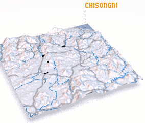 Places with similar names to Chisŏng-ni, Korea, North ::
// Shazaunggan (MM)
// Chezangūn (IR)
// Shāsangaon (BD)
// Chisankani (ZM)
// Chisŏng-ni (KP)
// Chisŏng-ni (KP)
// Ch'usang-ni (KP)
// Chusang-ni (KP)
// Chusang-ni (KP)
// Chaesong-ni (KR)
Disclaimer :: Information on this page comes without warranty of any kind |
||
|
Where is Chisŏng-ni? Elevation and coordinates ::
Latitude (lat): 38°35'34"N Longitude (lon): 127°45'15"E
Elevation (approx.): 297m (map arrows pan, magnifying glasses zoom) |
||
|
Visiting Chisŏng-ni? Hotel/Accommodation ::
Book a hotel in Chisŏng-ni Travel Guide ::
rental cars ::
car rental offers GPS waypoint ::
download a GPX waypoint (PoI) of Chisŏng-ni for your GPS receiver
|
||