|
search place name
|
||
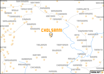
Ch'ŏlsan-ni (Korea, North)Ch'ŏlsan-ni is a town in Korea, North. An overview map of the region around Ch'ŏlsan-ni is displayed below.
regional and 3d topo map of Ch'ŏlsan-ni, Korea, North ::
Ch'ŏlsan-ni airports ::
The nearest airport is FNJ - Pyongyang Intl, located 94.8 km north west of Ch'ŏlsan-ni.
Other airports nearby include GMP - Seoul Gimpo (120.2 km south), SSN - Seoul East Seoul Ab (142.0 km south east), OSN - Osan Ab (176.0 km south), YEC - Yechon Yecheon (277.5 km south east), Nearby towns ::
Taech'on-ni (0.4km west) //
Taejŏng-ni (4.7km south west) //
Taep'yŏng-ni (4.8km south east) //
Yongp'o-ri (5.7km north) //
Sajŏng-ni (5.9km south) //
Nosŏ-dong (5.2km north west) //
Koeyŏm-ni (6.7km north) //
P'oŭmjang (7.2km north east) //
Sudŏng-ni (6.9km north west) //
Ch'ŏnam-ni (8.0km north) //
Uam-ni (8.5km south) //
Sango-dong (8.7km north) //
Hwaya-ri (8.6km south west) //
Pŏnji-ri (10.4km south east) //
[all distances 'as the bird flies' and approximate]  Places with similar names to Ch'ŏlsan-ni, Korea, North ::
// Chilson (US)
// Chilişeni (RO)
// Chelasin (RU)
// Chilizhnyy (RU)
// Chūl Zan (IR)
// Chilson (US)
// Chilson (US)
// Cholūsain (IN)
// Shalozān (PK)
// Ch'ilsan-ni (KP)
Disclaimer :: Information on this page comes without warranty of any kind |
||
|
Where is Ch'ŏlsan-ni? Elevation and coordinates ::
Latitude (lat): 38°36'0"N Longitude (lon): 126°25'0"E
Elevation (approx.): 112m (map arrows pan, magnifying glasses zoom) |
||
|
Visiting Ch'ŏlsan-ni? Hotel/Accommodation ::
Book a hotel in Ch'ŏlsan-ni Travel Guide ::
rental cars ::
car rental offers GPS waypoint ::
download a GPX waypoint (PoI) of Ch'ŏlsan-ni for your GPS receiver
|
||