|
search place name
|
||
Ch'ŏngbyŏrae (Hamgyŏng, Korea, North)Ch'ŏngbyŏrae is a town in the Hamgyŏng region of Korea, North. An overview map of the region around Ch'ŏngbyŏrae is displayed below.
regional and 3d topo map of Ch'ŏngbyŏrae, Korea, North ::
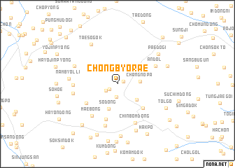
Nearby towns ::
Sanghadae (0.8km north east) //
Tŏngman-ni (1.3km south west) //
Kil-tong (2.1km south) //
Sŏyŏk-tong (1.8km south west) //
Changnop'a (2.8km east) //
Chungch'op'yŏng (3.4km south east) //
So-dong (4.1km south) //
Kobo (4.9km south east) //
Ŭmji-dong (4.8km south west) //
Yŏndae (5.8km south) //
Maebong (5.9km south west) //
Andol (5.4km north east) //
Chinbŏm-dong (6.5km south) //
Imga-dong (6.8km south) //
Nambyŏllinamjŏlso (5.4km west) //
Kansŏngdŏgi (5.5km west) //
Chich'o-ri (5.9km north west) //
Taesŏgok (7.1km north west) //
Nambyŏl-li (6.0km west) //
Somaebong (7.8km south) //
Paedŏgi (6.9km north east) //
K'ŭnmaebong (8.3km south) //
Chungbugŭn (6.7km north east) //
Sangyŏn-dong (7.8km south west) //
Tolgo (7.0km south east) //
Waryong-dong (8.5km south) //
Hakp'o (8.8km south east) //
Chŏngae (9.1km south) //
Pongjŏn-dong (8.5km south east) //
[all distances 'as the bird flies' and approximate] 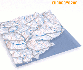 Places with similar names to Ch'ŏngbyŏrae, Korea, North :: Disclaimer :: Information on this page comes without warranty of any kind |
||
|
Where is Ch'ŏngbyŏrae? Elevation and coordinates ::
Latitude (lat): 40°56'28"N Longitude (lon): 128°59'42"E
Elevation (approx.): 834m (map arrows pan, magnifying glasses zoom) |
||
|
Visiting Ch'ŏngbyŏrae? Hotel/Accommodation ::
Book a hotel in Ch'ŏngbyŏrae Travel Guide ::
rental cars ::
car rental offers GPS waypoint ::
download a GPX waypoint (PoI) of Ch'ŏngbyŏrae for your GPS receiver
|
||