|
search place name
|
||
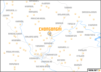
Chŏn'gong-ni (Kangwŏn, Korea, North)Chŏn'gong-ni is a town in the Kangwŏn region of Korea, North. An overview map of the region around Chŏn'gong-ni is displayed below.
regional and 3d topo map of Chŏn'gong-ni, Korea, North ::
Chŏn'gong-ni airports ::
The nearest airport is SHO - Sokch'o Sokcho, located 109.9 km south east of Chŏn'gong-ni.
Other airports nearby include GMP - Seoul Gimpo (153.7 km south west), SSN - Seoul East Seoul Ab (154.2 km south), KAG - Kangnung Gangneung (161.4 km south east), FNJ - Pyongyang Intl (176.9 km west), Nearby towns ::
Sangjŏntal-li (0.4km east) //
Hajŏnt'an-ni (0.9km south) //
Modŏng-ni (1.4km south west) //
Araemal (2.5km south west) //
Nŭngsal-li (3.1km north east) //
Saemal (2.8km west) //
Songp'o-ri (3.7km south) //
Sop'ung-ni (3.9km south) //
Huri-gol (3.3km west) //
Orang-ni (4.5km north east) //
Changmi-dong (4.8km south east) //
Yongp'o-ri (5.7km south west) //
Hagyo-ri (6.4km south east) //
Pakkchaha-gol (6.4km north west) //
Kamjŏng-dong (5.6km west) //
Chŏngja-gol (6.2km north west) //
Pakktuhŏsil (5.7km east) //
Kŭmdaeil-li (6.5km south east) //
Hoeyang-ŭp (7.3km south) //
Munnaedong-ni (6.9km south west) //
Tuhŏdong-ni (6.1km east) //
Ch'oil-li (7.5km south) //
Chŏnhang-ni (8.1km south) //
Kangdol-li (7.9km south) //
Ŭn'gye-ri (7.6km south west) //
Kach'ijae (6.8km south west) //
Ongjang-gol (7.9km north east) //
Tangch'i (7.1km north east) //
Majŏl-li (8.2km south west) //
[all distances 'as the bird flies' and approximate] 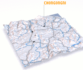 Places with similar names to Chŏn'gong-ni, Korea, North ::
// Chang Naogaon (BD)
// Chang Noāgaon (BD)
// Changgang-ni (KP)
// Changgong-ni (KP)
// Changgung-ni (KP)
// Ch'ŏnggang-ni (KP)
// Chŏnggong-ni (KP)
// Ch'ŏn'gong-ni (KP)
// Ch'ŏngong-ni (KP)
// Chungang-ni (KP)
Disclaimer :: Information on this page comes without warranty of any kind |
||
|
Where is Chŏn'gong-ni? Elevation and coordinates ::
Latitude (lat): 38°46'27"N Longitude (lon): 127°37'46"E
Elevation (approx.): 384m (map arrows pan, magnifying glasses zoom) |
||
|
Visiting Chŏn'gong-ni? Hotel/Accommodation ::
Book a hotel in Chŏn'gong-ni Travel Guide ::
rental cars ::
car rental offers GPS waypoint ::
download a GPX waypoint (PoI) of Chŏn'gong-ni for your GPS receiver
|
||