|
search place name
|
||
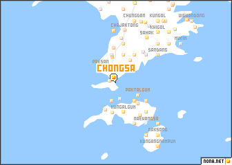
Chŏngsa (P'yŏngan, Korea, North)Chŏngsa is a town in the P'yŏngan region of Korea, North. An overview map of the region around Chŏngsa is displayed below.
regional and 3d topo map of Chŏngsa, Korea, North ::
Chŏngsa airports ::
The nearest airport is FNJ - Pyongyang Intl, located 97.8 km south east of Chŏngsa.
Nearby towns ::
Yongsap'o (0.8km west) //
Happ'o (2.2km north) //
Kuryŏng (2.7km south) //
Sinam-dong (2.7km north) //
Kibong-ni (2.7km north) //
Taebawi (3.0km south) //
Paesan (3.2km north west) //
Paktalgŭm (3.5km south east) //
Yaksu (4.1km north) //
K'ŭntalgŭm (3.8km south east) //
Chiok-tong (4.0km north east) //
Taman (4.4km north) //
T'an-dong (4.5km north) //
Changmok (4.7km south) //
Sogalgŭm (4.9km south) //
Kado-ri (4.4km south east) //
K'ŭngalgŭm (4.9km south) //
Chŏl-gol (5.0km north east) //
Posal-li (5.6km north) //
Chaktalgŭm (4.8km south east) //
Kusŏk (6.3km north) //
Sŏnsa (5.8km north east) //
Sŏnam-ni (6.0km north east) //
K'ŭnmulchu (6.2km south east) //
K'undalgŭm (6.2km south east) //
Kan-dong (7.2km north) //
K'ŭnp'andegi (7.1km south) //
Chŏnmak (6.8km north east) //
Sandang (6.8km north east) //
[all distances 'as the bird flies' and approximate] 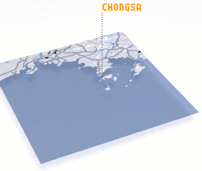 Places with similar names to Chŏngsa, Korea, North ::
Disclaimer :: Information on this page comes without warranty of any kind |
||
|
Where is Chŏngsa? Elevation and coordinates ::
Latitude (lat): 39°35'37"N Longitude (lon): 124°38'21"E
Elevation (approx.): 111m (map arrows pan, magnifying glasses zoom) |
||
|
Visiting Chŏngsa? Hotel/Accommodation ::
Book a hotel in Chŏngsa Travel Guide ::
rental cars ::
car rental offers GPS waypoint ::
download a GPX waypoint (PoI) of Chŏngsa for your GPS receiver
|
||