|
search place name
|
||
Ch'ŏngsong-ni (Hwanghae, Korea, North)Ch'ŏngsong-ni is a town in the Hwanghae region of Korea, North. An overview map of the region around Ch'ŏngsong-ni is displayed below.
regional and 3d topo map of Ch'ŏngsong-ni, Korea, North ::

Ch'ŏngsong-ni airports ::
The nearest airport is GMP - Seoul Gimpo, located 68.7 km south east of Ch'ŏngsong-ni.
Other airports nearby include SSN - Seoul East Seoul Ab (99.7 km south east), OSN - Osan Ab (118.7 km south east), FNJ - Pyongyang Intl (154.4 km north), KUB - Kunsan Ab (223.6 km south), Nearby towns ::
Masal-li (0.8km north) //
Songje-ri (0.9km south west) //
Chabong-ni (0.9km north east) //
Yonggol-tong (1.5km south west) //
Chadal-li (1.4km east) //
Sŏjŏng-ni (1.9km south) //
Songch'ŏng-ni (1.6km west) //
Tansal-li (2.2km north) //
Sojŏng-ni (1.8km east) //
Noryu-ri (1.9km north west) //
Songch'ŏl-li (2.2km south east) //
Manhwa-ri (2.1km west) //
Namsin-dong (2.6km south) //
Chŏngjamŏri (2.7km north) //
Hanjŏng-ni (2.5km south east) //
Chibang-gol (2.8km north) //
Tanji-ri (2.7km north west) //
Hosŏ-ri (2.8km south east) //
Nojŏng-ni (2.6km north west) //
Sanggalsan (2.9km south east) //
Kwangni-dong (3.3km south) //
Hagalsan (3.3km south) //
Saenggu-ri (3.1km south east) //
Pongmu-ri (3.3km north east) //
Ka-gol (3.5km north) //
Waryong-ni (3.0km north west) //
Chayang-ni (3.2km north east) //
Sinch'on-gol (3.1km north east) //
Kŏmidae (3.5km north) //
[all distances 'as the bird flies' and approximate] 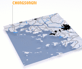 Places with similar names to Ch'ŏngsong-ni, Korea, North ::
// Changsaeng-ni (KP)
// Ch'angsang-ni (KP)
// Changsang-ni (KP)
// Changsang-ni (KP)
// Changsang-ni (KP)
// Ch'angsong-ni (KP)
// Changsŏng-ni (KP)
// Changsŭng-ni (KP)
// Ch'ŏngsang-ni (KP)
// Ch'ŏngsong-ni (KP)
Disclaimer :: Information on this page comes without warranty of any kind |
||
|
Where is Ch'ŏngsong-ni? Elevation and coordinates ::
Latitude (lat): 37°52'46"N Longitude (lon): 126°7'26"E
Elevation (approx.): 63m (map arrows pan, magnifying glasses zoom) |
||
|
Visiting Ch'ŏngsong-ni? Hotel/Accommodation ::
Book a hotel in Ch'ŏngsong-ni Travel Guide ::
rental cars ::
car rental offers GPS waypoint ::
download a GPX waypoint (PoI) of Ch'ŏngsong-ni for your GPS receiver
|
||