|
search place name
|
||
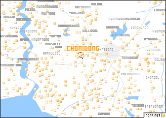
Choni-dong (Kaesŏng, Korea, North)Choni-dong is a town in the Kaesŏng region of Korea, North. An overview map of the region around Choni-dong is displayed below.
regional and 3d topo map of Choni-dong, Korea, North ::
Choni-dong airports ::
The nearest airport is GMP - Seoul Gimpo, located 51.1 km south east of Choni-dong.
Other airports nearby include SSN - Seoul East Seoul Ab (78.2 km south east), OSN - Osan Ab (106.9 km south east), FNJ - Pyongyang Intl (158.2 km north west), YEC - Yechon Yecheon (220.4 km south east), Nearby towns ::
Yŏllŭng-ni (0.6km north) //
Sŭnghak-tong (0.8km south) //
P'yŏng-dong (1.0km north west) //
Ami-gol (1.0km north west) //
Myŏngnŭng-dong (1.2km north) //
Norumok (1.0km west) //
Isammol (1.2km north east) //
Kukch'ŏng (1.3km north west) //
Cheryang-dong (1.6km south) //
Korŭng-dong (1.8km north) //
Yŏnha-ri (1.5km south west) //
Tumun-dong (1.8km north west) //
Taeguk-kol (1.7km east) //
Mudaek-kol (2.2km south west) //
T'aejorŭng-dong (2.5km north) //
Yulmok-tong (2.1km east) //
Kwangdam-ni (2.3km south east) //
Chak-tong (2.6km north west) //
Haesŏl-li (2.8km north) //
Ojŏngmun (2.4km north east) //
Kan-dong (2.5km south east) //
Yŏrŭm-ni (2.6km north east) //
Idap-tong (2.3km east) //
Nak-ch'on (2.5km south west) //
Ongnyŏn-gol (3.0km south) //
Kwangch'ŏl-li (3.0km south east) //
Paenamuk-kol (3.2km north) //
T'aep'yŏng-dong (2.7km east) //
Ch'illŭng-dong (3.5km north) //
[all distances 'as the bird flies' and approximate] 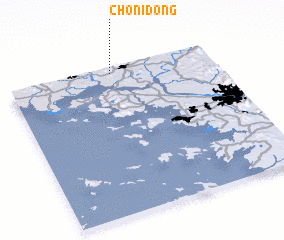 Places with similar names to Choni-dong, Korea, North ::
// Shandaung (MM)
// Shantaung (MM)
// Shantaungu (MM)
// Shanting (MM)
// Sheing Htang (MM)
// Chuntang (IN)
// Chantung (GH)
// Chandanke (PK)
// Chain-dong (KP)
// Ch'angho-dong (KP)
Disclaimer :: Information on this page comes without warranty of any kind |
||
|
Where is Choni-dong? Elevation and coordinates ::
Latitude (lat): 37°57'34"N Longitude (lon): 126°30'23"E
Elevation (approx.): 67m (map arrows pan, magnifying glasses zoom) |
||
|
Visiting Choni-dong? Hotel/Accommodation ::
Book a hotel in Choni-dong Travel Guide ::
rental cars ::
car rental offers GPS waypoint ::
download a GPX waypoint (PoI) of Choni-dong for your GPS receiver
|
||