|
search place name
|
||
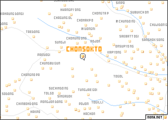
Ch'ŏnsŏkt'ŏ (Hamgyŏng, Korea, North)Ch'ŏnsŏkt'ŏ is a town in the Hamgyŏng region of Korea, North. An overview map of the region around Ch'ŏnsŏkt'ŏ is displayed below.
regional and 3d topo map of Ch'ŏnsŏkt'ŏ, Korea, North ::
Nearby towns ::
Sŭngbang-gol (2.6km north) //
Chinja-dong (2.4km south east) //
Sangbugŭn (2.8km south west) //
Namsŏk (4.0km north) //
Ch'omun-dong (3.9km north) //
Pojŏn (3.7km north east) //
Ch'aeyang-dong (3.4km north east) //
Odŭng-ch'on (4.0km south east) //
P'anmak-tong (4.1km south west) //
Sŏnbau-gol (4.7km south) //
Nammyŏn-dong (4.1km east) //
Tan-dong (4.2km east) //
Samgŏri (5.5km north) //
Ch'ang-ch'on (5.4km south east) //
Maengyang-dong (4.6km north west) //
Sŭngji (4.8km north west) //
Imdong-ni (5.9km north) //
Imdongjŏl-gol (5.6km north east) //
Araegŭm-ch'on (6.3km north) //
Kap'yŏng (5.3km east) //
Wikkŭm-ch'on (7.1km north) //
Hanch'amsu-dong (7.3km south) //
Ch'oesŭng-dong (6.1km north east) //
Chungbugŭn (5.9km west) //
Ch'omakp'o (7.8km north) //
Tŭngjaegŏi (7.8km south) //
Chŏngsŏngdŏgi (7.0km south east) //
Sŏdu-gol (8.0km north) //
Kwan-dong (6.8km north west) //
[all distances 'as the bird flies' and approximate]  Places with similar names to Ch'ŏnsŏkt'ŏ, Korea, North :: Disclaimer :: Information on this page comes without warranty of any kind |
||
|
Where is Ch'ŏnsŏkt'ŏ? Elevation and coordinates ::
Latitude (lat): 40°59'0"N Longitude (lon): 129°8'0"E
Elevation (approx.): 891m (map arrows pan, magnifying glasses zoom) |
||
|
Visiting Ch'ŏnsŏkt'ŏ? Hotel/Accommodation ::
Book a hotel in Ch'ŏnsŏkt'ŏ Travel Guide ::
rental cars ::
car rental offers GPS waypoint ::
download a GPX waypoint (PoI) of Ch'ŏnsŏkt'ŏ for your GPS receiver
|
||