|
search place name
|
||
Chugamdonggu (Chagang, Korea, North)Chugamdonggu is a town in the Chagang region of Korea, North. An overview map of the region around Chugamdonggu is displayed below.
regional and 3d topo map of Chugamdonggu, Korea, North ::

Nearby towns ::
Horye-ri (0.3km east) //
Namp'o-dong (1.0km east) //
Kujŏm-dong (1.1km west) //
Kalbat-kol (1.7km west) //
Horyedonggu (2.2km west) //
Hoeyang-dong (3.2km south) //
Pakchoktŏgi (3.6km south) //
Samgŏ-ri (2.7km east) //
Hwangch'ŏltŏgi (4.0km south) //
Hwap'yŏng-dong (3.5km south west) //
Haengjangp'yŏng (3.7km south west) //
Taesa-dong (4.5km south) //
Sangp'yŏng-ni (4.7km south) //
Majŏn-dong (3.6km east) //
Ŭmnae-dong (4.3km south west) //
Ongsŏng-dong (3.7km west) //
Kwanp'yŏng-ni (5.0km south east) //
Chagae-dong (4.2km east) //
Sang-dong (5.5km south) //
Chasŏng-ŭp (5.0km south west) //
Ch'angp'yŏng (5.3km south east) //
Songam-ni (5.0km north west) //
Tonggu (6.2km south) //
Songt'an-dong (5.6km south east) //
Hwajŏl-li (5.3km west) //
Kwiil-li (7.6km south) //
Chik-tong (6.3km north east) //
Paekpan-dong (6.2km south east) //
Such'im-ni (6.6km south west) //
[all distances 'as the bird flies' and approximate] 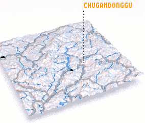 Places with similar names to Chugamdonggu, Korea, North ::
Disclaimer :: Information on this page comes without warranty of any kind |
||
|
Where is Chugamdonggu? Elevation and coordinates ::
Latitude (lat): 41°29'22"N Longitude (lon): 126°41'14"E
Elevation (approx.): 374m (map arrows pan, magnifying glasses zoom) |
||
|
Visiting Chugamdonggu? Hotel/Accommodation ::
Book a hotel in Chugamdonggu Travel Guide ::
rental cars ::
car rental offers GPS waypoint ::
download a GPX waypoint (PoI) of Chugamdonggu for your GPS receiver
|
||