|
search place name
|
||
Ch'ukp'o-ri (Chagang, Korea, North)Ch'ukp'o-ri is a town in the Chagang region of Korea, North. An overview map of the region around Ch'ukp'o-ri is displayed below.
regional and 3d topo map of Ch'ukp'o-ri, Korea, North ::

Ch'ukp'o-ri airports ::
The nearest airport is FNJ - Pyongyang Intl, located 192.0 km south of Ch'ukp'o-ri.
Nearby towns ::
Ch'omak-tong (3.1km south west) //
P'anmak-tong(1) (6.3km north west) //
Ch'ŏnbong-dong (7.1km north) //
Ch'angp'yŏng-ni (6.0km south west) //
Hyangbat'-kol (7.4km north) //
Much'aech'am(2) (6.7km east) //
Toksan-dong (7.7km south west) //
Paeksan-dong (9.2km south west) //
T'ongsach'am (10.0km south east) //
[all distances 'as the bird flies' and approximate] 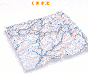 Places with similar names to Ch'ukp'o-ri, Korea, North ::
// Chakpāra (BD)
// Chak Pārua (BD)
// Chak Piar (BD)
// Chaukiāpāra (BD)
// Chaukipāra (BD)
// Sheikhpāra (BD)
// Sheikhpāra (BD)
// Sheikhpur (BD)
// Sheikhpur (BD)
// Sheikhpura (BD)
Disclaimer :: Information on this page comes without warranty of any kind |
||
|
Where is Ch'ukp'o-ri? Elevation and coordinates ::
Latitude (lat): 40°51'12"N Longitude (lon): 126°25'31"E
Elevation (approx.): 539m (map arrows pan, magnifying glasses zoom) |
||
|
Visiting Ch'ukp'o-ri? Hotel/Accommodation ::
Book a hotel in Ch'ukp'o-ri Travel Guide ::
rental cars ::
car rental offers GPS waypoint ::
download a GPX waypoint (PoI) of Ch'ukp'o-ri for your GPS receiver
|
||