|
search place name
|
||
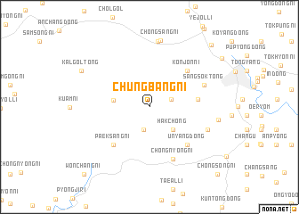
Chungbang-ni (P'yŏngan, Korea, North)Chungbang-ni is a town in the P'yŏngan region of Korea, North. An overview map of the region around Chungbang-ni is displayed below.
regional and 3d topo map of Chungbang-ni, Korea, North ::
Chungbang-ni airports ::
The nearest airport is FNJ - Pyongyang Intl, located 91.1 km south east of Chungbang-ni.
Nearby towns ::
Sangbang (2.3km north east) //
Taesŏng (2.9km south) //
Hakchŏng (3.6km south east) //
Unp'ung-ni (3.5km west) //
Sinp'ung-ni (4.7km east) //
Paeksang-ni (5.8km south west) //
Kŏnjŏn-ni (5.8km north east) //
Unyang-dong (6.0km south east) //
Ch'ŏngnyong-ni (7.0km south) //
Sangsŏk-tong (6.0km north east) //
P'yŏngji-dong (6.3km south east) //
Igu-ri (8.3km north) //
Ch'ŏngsang-ni (8.4km north) //
Wangil-li (6.9km east) //
Kalgol-tong (8.0km north west) //
Ijung-ni (9.8km north east) //
Wŏnch'ang-ni (10.5km south west) //
Ch'ŏngsong-ni (10.7km south east) //
[all distances 'as the bird flies' and approximate] 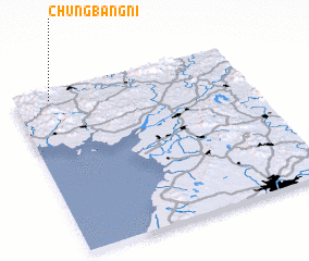 Places with similar names to Chungbang-ni, Korea, North ::
// Changbaeng-ni (KP)
// Changbang-ni (KP)
// Changbang-ni (KP)
// Ch'ŏngbaeng-ni (KP)
// Chŏngbang-ni (KP)
// Chŏngbong-ni (KP)
// Chungbong-ni (KP)
// Chungbung-ni (KP)
// Changbaeng-ni (KR)
// Ch'angbong-ni (KR)
Disclaimer :: Information on this page comes without warranty of any kind |
||
|
Where is Chungbang-ni? Elevation and coordinates ::
Latitude (lat): 39°56'33"N Longitude (lon): 125°9'25"E
Elevation (approx.): 175m (map arrows pan, magnifying glasses zoom) |
||
|
Visiting Chungbang-ni? Hotel/Accommodation ::
Book a hotel in Chungbang-ni Travel Guide ::
rental cars ::
car rental offers GPS waypoint ::
download a GPX waypoint (PoI) of Chungbang-ni for your GPS receiver
|
||