|
search place name
|
||
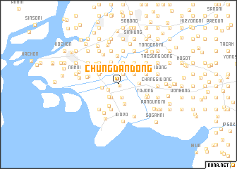
Chungdan-dong (P'yŏngan, Korea, North)Chungdan-dong is a town in the P'yŏngan region of Korea, North. An overview map of the region around Chungdan-dong is displayed below.
regional and 3d topo map of Chungdan-dong, Korea, North ::
Chungdan-dong airports ::
The nearest airport is FNJ - Pyongyang Intl, located 128.5 km south east of Chungdan-dong.
Nearby towns ::
Yongbung-ni (0.2km south east) //
Sŏsi (1.7km north) //
Sinjŏng-ni (1.5km south west) //
Sapto (2.1km south) //
Chunggok (2.3km south west) //
Kanŭnsŏm (2.3km south west) //
Unhyangp'o (2.1km west) //
Wŏnhŭng (2.5km north east) //
Ponghwang (2.5km north east) //
Sŏk-tong (3.1km south) //
Namgi-dong (2.6km east) //
Tanggol (2.8km north west) //
Sŏgyŏm-dong (2.8km north west) //
Tongdan-dong (2.9km north west) //
Hajang-dong (3.5km north) //
Ch'ujŏng-dong (3.5km north) //
Namsŭng (3.6km north) //
Tongsŭng (3.6km north) //
Pukkyŏmje (3.6km south) //
Namgyŏmje (4.1km south) //
Tangbuk-tong (4.0km north east) //
Tongjang (4.5km north) //
Sŏsŭng (4.2km north west) //
Tŏkch'ŏn-dong (4.2km north west) //
Tŏksŭng-ni (4.1km north west) //
Tobong-ni (4.0km north east) //
Sinhŭng (3.7km north east) //
Chŏmbong (3.7km north east) //
Pomin-dong (3.7km north east) //
[all distances 'as the bird flies' and approximate]  Places with similar names to Chungdan-dong, Korea, North ::
Disclaimer :: Information on this page comes without warranty of any kind |
||
|
Where is Chungdan-dong? Elevation and coordinates ::
Latitude (lat): 39°53'8"N Longitude (lon): 124°26'38"E
Elevation (approx.): 6m (map arrows pan, magnifying glasses zoom) |
||
|
Visiting Chungdan-dong? Hotel/Accommodation ::
Book a hotel in Chungdan-dong Travel Guide ::
rental cars ::
car rental offers GPS waypoint ::
download a GPX waypoint (PoI) of Chungdan-dong for your GPS receiver
|
||