|
search place name
|
||
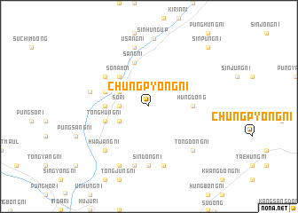
Chungp'yŏng-ni (Korea, North)Chungp'yŏng-ni is a town in Korea, North. An overview map of the region around Chungp'yŏng-ni is displayed below.
regional and 3d topo map of Chungp'yŏng-ni, Korea, North ::
Chungp'yŏng-ni airports ::
The nearest airport is FNJ - Pyongyang Intl, located 189.3 km south west of Chungp'yŏng-ni.
Other airports nearby include SHO - Sokch'o Sokcho (237.2 km south east), Nearby towns ::
Sŏ-ri (2.8km west) //
Wŏnp'yŏngjang (3.4km north west) //
Wŏndong-ni (3.4km north west) //
Chungsang-ni (3.4km south west) //
Sŏnam-ni (4.7km north west) //
Kwansu-ri (4.3km west) //
Hŭng-dong (4.3km east) //
Chŏndong-ni (4.6km north west) //
Tonghŭng-ni (4.6km south west) //
Hŭngbong-ni (5.7km north) //
Sang-ni (5.7km north) //
Ch'ŏnbulsan-ni (5.6km north west) //
P'ungsŏ-ri (5.6km north west) //
Sinsŏng-ni (7.4km south) //
Sindŏng-ni (7.4km south) //
Usang-ni (7.5km north) //
Changjŏn-ni (6.0km west) //
Samhŭng-ni (7.5km south) //
Sangjing-ni (7.5km south) //
Tongdŏng-ni (7.0km south east) //
Hwajang-ni (7.0km south west) //
Tonghŭng-ni (7.9km south) //
Sinhŭng-ŭp (8.5km north) //
Sinp'ung-ni (9.3km north east) //
[all distances 'as the bird flies' and approximate] 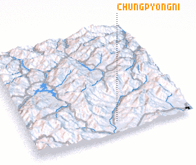 Places with similar names to Chungp'yŏng-ni, Korea, North ::
// Ch'angp'yŏng-ni (KP)
// Ch'angp'yŏng-ni (KP)
// Ch'angp'yŏng-ni (KP)
// Ch'angp'yŏng-ni (KP)
// Ch'angp'yŏng-ni (KP)
// Changp'yŏng-ni (KP)
// Changp'yŏng-ni (KP)
// Changp'yŏng-ni (KP)
// Chŏngp'yŏng-ni (KP)
// Chŏngp'yŏng-ni (KP)
Disclaimer :: Information on this page comes without warranty of any kind |
||
|
Where is Chungp'yŏng-ni? Elevation and coordinates ::
Latitude (lat): 40°7'0"N Longitude (lon): 127°33'0"E
Elevation (approx.): 223m (map arrows pan, magnifying glasses zoom) |
||
|
Visiting Chungp'yŏng-ni? Hotel/Accommodation ::
Book a hotel in Chungp'yŏng-ni Travel Guide ::
rental cars ::
car rental offers GPS waypoint ::
download a GPX waypoint (PoI) of Chungp'yŏng-ni for your GPS receiver
|
||