|
search place name
|
||
Chungp'yŏng-ni (Yanggang, Korea, North)Chungp'yŏng-ni is a town in the Yanggang region of Korea, North. An overview map of the region around Chungp'yŏng-ni is displayed below.
regional and 3d topo map of Chungp'yŏng-ni, Korea, North ::

Nearby towns ::
Hamyŏl-li (2.1km north east) //
Naedong-ni (3.1km south) //
Kwangsaeng-ni (2.6km east) //
Kwanp'yŏng-ni (2.8km west) //
Chaeham-ni (3.4km north west) //
Koamdŏk (4.0km south) //
Kwajŏl-li (4.1km north) //
Sangbal-li (4.2km south) //
Sinjŏl-li (4.1km north west) //
Kwanhŭng-ni (3.5km west) //
Chaejŏl-li (4.4km north west) //
Hyojang-ni (4.0km south east) //
Sŏro-gol (4.0km east) //
Unch'ŏn-ni (4.1km east) //
Ponp'ŏ-ri (4.5km east) //
Changhang-ni (5.8km south) //
T'aptong-ni (5.1km west) //
Yongsu-ri (5.5km south west) //
Pubyŏl-li (5.3km east) //
Nŭpp'o-ri (5.6km south east) //
Ilgŏl-li (6.7km south west) //
Sŏngnae-ri (5.7km north west) //
Sinch'ŏl-li (5.6km west) //
Wigye-ri (6.4km south east) //
Changga-ri (7.3km south) //
Kwandong-ni (5.8km west) //
Majŏn (7.3km south) //
Sangdong-ni (6.1km north east) //
Tongsu-ri (5.8km west) //
[all distances 'as the bird flies' and approximate] 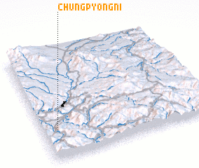 Places with similar names to Chungp'yŏng-ni, Korea, North ::
// Ch'angp'yŏng-ni (KP)
// Ch'angp'yŏng-ni (KP)
// Ch'angp'yŏng-ni (KP)
// Ch'angp'yŏng-ni (KP)
// Ch'angp'yŏng-ni (KP)
// Changp'yŏng-ni (KP)
// Changp'yŏng-ni (KP)
// Changp'yŏng-ni (KP)
// Chŏngp'yŏng-ni (KP)
// Chŏngp'yŏng-ni (KP)
Disclaimer :: Information on this page comes without warranty of any kind |
||
|
Where is Chungp'yŏng-ni? Elevation and coordinates ::
Latitude (lat): 41°16'41"N Longitude (lon): 128°5'14"E
Elevation (approx.): 821m (map arrows pan, magnifying glasses zoom) |
||
|
Visiting Chungp'yŏng-ni? Hotel/Accommodation ::
Book a hotel in Chungp'yŏng-ni Travel Guide ::
rental cars ::
car rental offers GPS waypoint ::
download a GPX waypoint (PoI) of Chungp'yŏng-ni for your GPS receiver
|
||