|
search place name
|
||
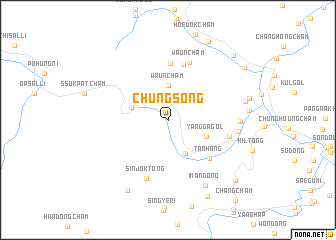
Chungsŏng (Chagang, Korea, North)Chungsŏng is a town in the Chagang region of Korea, North. An overview map of the region around Chungsŏng is displayed below.
regional and 3d topo map of Chungsŏng, Korea, North ::
Chungsŏng airports ::
The nearest airport is FNJ - Pyongyang Intl, located 165.9 km south of Chungsŏng.
Nearby towns ::
Waunch'am (3.9km north) //
Kadagot (4.0km south) //
Changsŏng (3.4km north west) //
Yangga-gol (3.7km south east) //
T'anhang (5.5km south east) //
P'anmak-tong (6.3km north) //
Waul-li (6.3km north) //
Waunch'am (6.7km north) //
Sinjŏk-tong (6.8km south) //
Sodang-gol (5.5km east) //
Sinjŏng-nodongjagu (6.1km east) //
Ch'u-dong (6.1km east) //
Iman-dong (8.0km south east) //
Taeyang-ni (6.9km east) //
Taegyegan (8.6km south west) //
Kangsŏ-gol (9.1km south) //
Ch'angdŏng-ni (9.4km north) //
Kogae-dong (8.9km south east) //
Changnim-ni (8.7km north east) //
Ch'angpyŏngch'am (9.1km north east) //
[all distances 'as the bird flies' and approximate] 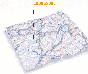 Places with similar names to Chungsŏng, Korea, North ::
// Tionok Sangué (SN)
// Changsŏng (KP)
// Changsong (KP)
// Chŏngsang (KP)
// Changsŏng (KR)
// Changsŏng (KR)
// Changsŏnggŏ (KR)
// Changsŭng (KR)
// Changsŭnggae (KR)
// Chongsaeng (KR)
Disclaimer :: Information on this page comes without warranty of any kind |
||
|
Where is Chungsŏng? Elevation and coordinates ::
Latitude (lat): 40°37'25"N Longitude (lon): 126°21'2"E
Elevation (approx.): 661m (map arrows pan, magnifying glasses zoom) |
||
|
Visiting Chungsŏng? Hotel/Accommodation ::
Book a hotel in Chungsŏng Travel Guide ::
rental cars ::
car rental offers GPS waypoint ::
download a GPX waypoint (PoI) of Chungsŏng for your GPS receiver
|
||