|
search place name
|
||
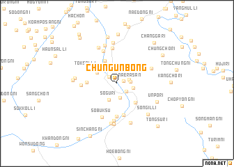
Chungunbong (Yanggang, Korea, North)Chungunbong is a town in the Yanggang region of Korea, North. An overview map of the region around Chungunbong is displayed below.
regional and 3d topo map of Chungunbong, Korea, North ::
Nearby towns ::
Hoe-dong (0.9km north east) //
Kyohangch'on (1.5km north west) //
Sangunbong (1.8km south east) //
Hoesal-li (1.6km north east) //
Naerasan (1.6km east) //
Hasŏng-ni (2.3km south) //
Unbong-ni (2.6km north west) //
Naesal-li (2.1km east) //
Sŏgu-ri (2.8km south) //
Chungp'yŏngsang-ni (3.2km north west) //
Hwayang-ni (3.0km north west) //
Chungp'yŏngjang-ni (3.4km north west) //
Chungp'yŏngha-ri (4.0km north) //
Wŏndong-ni (3.8km south east) //
Hwasanjung-ni (3.7km west) //
Ch'ŏnp'yŏng-ni (5.1km south) //
Ch'ŏnnam-ni (5.3km south) //
Toksal-li (4.3km north west) //
Sinsŏng-ni (5.6km north) //
Ch'ŏngsan (5.5km north) //
Hwasansang-ni (4.3km west) //
Sobuksu (5.7km south) //
Yup'yŏng-ni (5.9km south) //
Namhyang-ni (4.8km north east) //
Pallyonggi-ri (6.2km north) //
Kamaedŏng-ni (6.1km north) //
Majŏn (6.5km north) //
Namp'ung-ni (6.5km south) //
Wŏnnam-ni (6.6km south) //
[all distances 'as the bird flies' and approximate] 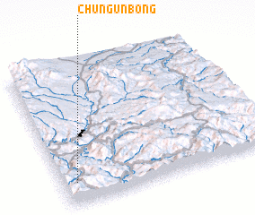 Places with similar names to Chungunbong, Korea, North :: Disclaimer :: Information on this page comes without warranty of any kind |
||
|
Where is Chungunbong? Elevation and coordinates ::
Latitude (lat): 41°9'30"N Longitude (lon): 128°3'46"E
Elevation (approx.): 1035m (map arrows pan, magnifying glasses zoom) |
||
|
Visiting Chungunbong? Hotel/Accommodation ::
Book a hotel in Chungunbong Travel Guide ::
rental cars ::
car rental offers GPS waypoint ::
download a GPX waypoint (PoI) of Chungunbong for your GPS receiver
|
||