|
search place name
|
||
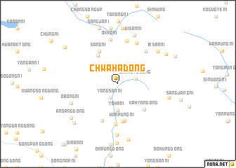
Chwaha-dong (P'yŏngan, Korea, North)Chwaha-dong is a town in the P'yŏngan region of Korea, North. An overview map of the region around Chwaha-dong is displayed below.
regional and 3d topo map of Chwaha-dong, Korea, North ::
Chwaha-dong airports ::
The nearest airport is FNJ - Pyongyang Intl, located 130.2 km south of Chwaha-dong.
Nearby towns ::
Yangsan-ni (2.4km south) //
Changt'o-dong (2.3km east) //
Yoha-ri (4.1km south) //
Sangdan-dong (5.1km north west) //
Kahyŏn-dong (5.2km south east) //
Sinp'ung-dong (5.9km south) //
Wŏnp'ung-ni (6.0km south) //
Sang-ni (5.7km north west) //
Hakp'o-dong (6.2km south) //
Wŏn-ni (6.4km south) //
Kach'ang-ni (6.2km north east) //
Hwajung-ni (7.0km north) //
Okp'o-ri (7.1km north) //
Sinp'ung-ni (6.9km north) //
Wasang-dong (8.1km south) //
Obong-ni (6.5km south west) //
Insan-ni (7.1km north east) //
Ŭisan-ni (8.0km north) //
Changt'o-ri (6.6km east) //
Talsan-ni (8.9km north) //
Yunp'ung-ni (7.5km north east) //
Chungdan-ni (8.9km north) //
Yŏkchi-dong (9.0km south) //
Ansang-dong (7.8km south west) //
Sinhŭng-dong (8.2km south west) //
Sangja-ri (9.2km north) //
Chungdan-dong (8.7km north west) //
[all distances 'as the bird flies' and approximate] 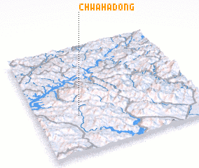 Places with similar names to Chwaha-dong, Korea, North ::
// Chwaha-dong (KP)
Disclaimer :: Information on this page comes without warranty of any kind |
||
|
Where is Chwaha-dong? Elevation and coordinates ::
Latitude (lat): 40°21'12"N Longitude (lon): 125°15'37"E
Elevation (approx.): 380m (map arrows pan, magnifying glasses zoom) |
||
|
Visiting Chwaha-dong? Hotel/Accommodation ::
Book a hotel in Chwaha-dong Travel Guide ::
rental cars ::
car rental offers GPS waypoint ::
download a GPX waypoint (PoI) of Chwaha-dong for your GPS receiver
|
||