|
search place name
|
||
Hagadŏk (Hamgyŏng, Korea, North)Hagadŏk is a town in the Hamgyŏng region of Korea, North. An overview map of the region around Hagadŏk is displayed below.
regional and 3d topo map of Hagadŏk, Korea, North ::

Nearby towns ::
Sanggadŏk (0.7km north) //
Tŏkchŏ (0.8km north east) //
Yangp'yŏng-ni (1.0km north west) //
Namsan-gol (1.1km south east) //
Nop'yŏng (1.2km north east) //
Pyŏrhak-ch'on (1.2km north east) //
Talchŏl-li (1.8km north west) //
Sanyang-ch'on (1.9km north) //
Sang-ch'on (1.7km east) //
Koŭm-ni (2.3km east) //
Ha-ch'on (2.3km east) //
Changsadae (2.8km east) //
Pingae-ch'on (3.0km north east) //
Changyang-dong (3.0km south east) //
Yŏndae-ri (3.3km south east) //
Yŏndaerian-gol (3.7km south east) //
Tŏk-kol (3.6km south west) //
Sinhŭng-ch'on (4.5km south) //
U-ch'on (4.4km south) //
Chŏktaedŏk (4.0km south east) //
Tok-kol (4.7km south) //
Chung-ch'on (4.6km south east) //
Paeksal-li (4.9km south) //
Tongdae (3.9km east) //
Kuŏk-ch'on (4.7km north east) //
Yang-ch'on (4.7km north east) //
Hyemok-ch'on (4.8km north west) //
Songp'a-ri (5.2km north east) //
Chikchŏl-tong (4.6km south east) //
[all distances 'as the bird flies' and approximate] 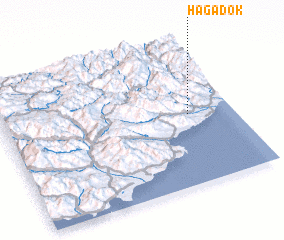 Places with similar names to Hagadŏk, Korea, North ::
Disclaimer :: Information on this page comes without warranty of any kind |
||
|
Where is Hagadŏk? Elevation and coordinates ::
Latitude (lat): 40°29'27"N Longitude (lon): 128°48'31"E
Elevation (approx.): 138m (map arrows pan, magnifying glasses zoom) |
||
|
Visiting Hagadŏk? Hotel/Accommodation ::
Book a hotel in Hagadŏk Travel Guide ::
rental cars ::
car rental offers GPS waypoint ::
download a GPX waypoint (PoI) of Hagadŏk for your GPS receiver
|
||