|
search place name
|
||
Handang-ni (Hamgyŏng, Korea, North)Handang-ni is a town in the Hamgyŏng region of Korea, North. An overview map of the region around Handang-ni is displayed below.
regional and 3d topo map of Handang-ni, Korea, North ::

Nearby towns ::
Hayujŏng-ni (0.9km south) //
Chŏlgorŏgu (2.1km north west) //
Kuŭm-ni (2.0km south east) //
Taeo-ri (1.8km north east) //
Songnodaeri (1.9km south west) //
Songdong-ni (2.0km south west) //
Ansi-ri (3.6km south) //
Chungp'o (3.6km south) //
Tŏksŏng-ni (3.4km south west) //
Hajŏl-li (3.5km north west) //
Yongbung-ni (3.0km east) //
Ponghyŏl-li (3.3km south east) //
Kimssi-gol (3.1km east) //
Angsidong-ni (3.5km north west) //
Sŏngdong-ni (3.8km south west) //
Sang-ch'on (4.7km north) //
Munang-ni (3.8km north west) //
Taehŭngni-hach'on (4.4km north east) //
Songjŏng-ni (4.9km south) //
Kokch'ang-ni (5.0km south) //
Suhang-ni (5.4km south) //
Ch'uksang (4.4km east) //
Wigye-ri (4.7km south east) //
Munho-ri (6.0km south) //
Taehwari-sangch'on (6.2km north east) //
Hŏsŏng-ni (7.0km south) //
Iwŏn-ŭp (5.7km south east) //
Chung-ch'on (6.1km north east) //
Changch'ung-ni (5.6km east) //
[all distances 'as the bird flies' and approximate] 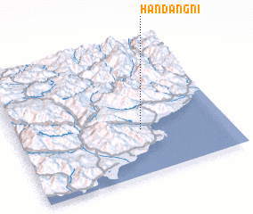 Places with similar names to Handang-ni, Korea, North ::
// Handong-ni (KP)
// Handong-ni (KR)
Disclaimer :: Information on this page comes without warranty of any kind |
||
|
Where is Handang-ni? Elevation and coordinates ::
Latitude (lat): 40°20'44"N Longitude (lon): 128°35'41"E
Elevation (approx.): 37m (map arrows pan, magnifying glasses zoom) |
||
|
Visiting Handang-ni? Hotel/Accommodation ::
Book a hotel in Handang-ni Travel Guide ::
rental cars ::
car rental offers GPS waypoint ::
download a GPX waypoint (PoI) of Handang-ni for your GPS receiver
|
||