|
search place name
|
||
Haripsŏng-ni (Hamgyŏng, Korea, North)Haripsŏng-ni is a town in the Hamgyŏng region of Korea, North. An overview map of the region around Haripsŏng-ni is displayed below.
regional and 3d topo map of Haripsŏng-ni, Korea, North ::
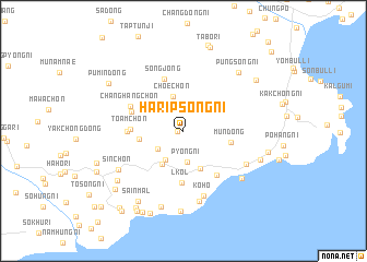
Nearby towns ::
Sangnipsŏng-ni (0.4km west) //
Pingin-ch'on (2.7km south west) //
P'yŏng-ni (3.2km south) //
Sŏngch'ŏn-ch'on (3.2km south west) //
Ch'oe-ch'on (3.6km north) //
Hasedong-ni (3.8km south west) //
Pansong-ni (4.1km south) //
Haksong-ch'on (3.6km west) //
Mun-dong (3.9km east) //
l-kol (5.3km south) //
Toam-ch'on (4.1km west) //
Such'im-dong (4.5km north west) //
Songjong (5.5km north) //
Hongjin (5.2km south east) //
Sangsedong-ni (4.4km west) //
Changhang-ch'on (4.8km north west) //
Kŏho (6.8km south) //
Kŏnja-ri (6.0km south east) //
Madŭk (7.3km south) //
Kŏnjap'o (6.7km south east) //
Sin-ch'on (6.4km south west) //
Manch'ul-li (7.9km south) //
Taemanch'un (8.2km south) //
P'ungsŏng-ni (7.4km north east) //
Ch'anghŭng-ni (6.7km south east) //
Kyŏngandae-ri (7.3km south west) //
Sain-mal (8.0km south west) //
Nahŭng-nodongjagu (7.0km east) //
Tabo-ri (8.8km north) //
[all distances 'as the bird flies' and approximate] 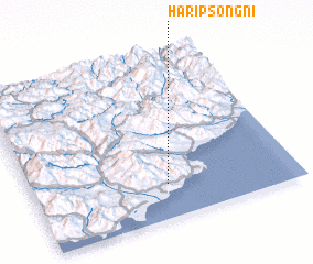 Places with similar names to Haripsŏng-ni, Korea, North :: Disclaimer :: Information on this page comes without warranty of any kind |
||
|
Where is Haripsŏng-ni? Elevation and coordinates ::
Latitude (lat): 40°12'36"N Longitude (lon): 128°30'45"E
Elevation (approx.): 67m (map arrows pan, magnifying glasses zoom) |
||
|
Visiting Haripsŏng-ni? Hotel/Accommodation ::
Book a hotel in Haripsŏng-ni Travel Guide ::
rental cars ::
car rental offers GPS waypoint ::
download a GPX waypoint (PoI) of Haripsŏng-ni for your GPS receiver
|
||