|
search place name
|
||
Honam-ni (Hamgyŏng, Korea, North)Honam-ni is a town in the Hamgyŏng region of Korea, North. An overview map of the region around Honam-ni is displayed below.
regional and 3d topo map of Honam-ni, Korea, North ::

Honam-ni airports ::
The nearest airport is SHO - Sokch'o Sokcho, located 213.8 km south of Honam-ni.
Nearby towns ::
Namho-ri (0.8km east) //
Yejŏkki (0.9km south east) //
Ŏŭn-dong (1.3km south east) //
Namp'ung (1.6km north) //
Tangjŏnch'on (1.6km north) //
Sinho (1.7km north east) //
Saju-mal (2.7km north east) //
Solsŏm (3.1km south east) //
Tong-ni (3.6km north west) //
Kangsang-nodongjagu (3.9km north east) //
Kanggye-gol (4.0km north east) //
Tongho-dong (4.3km north west) //
Homanp'o-ri (5.0km north) //
Ŭiho-ri (5.0km north east) //
Namgoji (5.5km west) //
Yanghwa-ri (6.2km north west) //
Sinho-ri (5.9km west) //
Kŭmho-ri (7.2km north east) //
Puch'ang-ni (6.5km north west) //
Omae-ri (8.3km north) //
Pudong-ni (8.8km north) //
Munam-ni (8.6km south west) //
[all distances 'as the bird flies' and approximate] 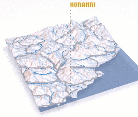 Places with similar names to Honam-ni, Korea, North ::
// Hanau am Main (DE)
// Hannemannei (DE)
// Hahnaman (US)
// Heineman (US)
// Hanmaen (ID)
// Hīnemān (IR)
// Haenam-ni (KP)
// Hanam-ni (KP)
// Hanam-ni (KP)
// Hanam-ni (KP)
Disclaimer :: Information on this page comes without warranty of any kind |
||
|
Where is Honam-ni? Elevation and coordinates ::
Latitude (lat): 40°3'11"N Longitude (lon): 128°17'26"E
Elevation (approx.): 11m (map arrows pan, magnifying glasses zoom) |
||
|
Visiting Honam-ni? Hotel/Accommodation ::
Book a hotel in Honam-ni Travel Guide ::
rental cars ::
car rental offers GPS waypoint ::
download a GPX waypoint (PoI) of Honam-ni for your GPS receiver
|
||