|
search place name
|
||
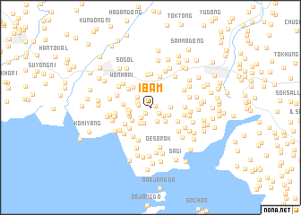
Ibam (P'yŏngan, Korea, North)Ibam is a town in the P'yŏngan region of Korea, North. An overview map of the region around Ibam is displayed below.
regional and 3d topo map of Ibam, Korea, North ::
Ibam airports ::
The nearest airport is FNJ - Pyongyang Intl, located 65.2 km south east of Ibam.
Nearby towns ::
Chang-dong (0.5km east) //
Nam-ni (0.9km south west) //
Sŏho-ri (1.1km south east) //
Sanp'o (1.2km west) //
Ch'ang-dong (1.4km north west) //
Wŏnp'o-ri (1.6km south west) //
Sŏgang (1.6km south east) //
Tonggang (1.9km south) //
Yŏn'gogae (1.8km north west) //
Kajang-dong (2.1km south) //
Sang-ni (2.3km south west) //
Kuhyang (2.0km south east) //
Sang-dong (1.9km east) //
Su-dong (2.3km south east) //
Kasan-dong (2.1km west) //
Sinyŏng-dong (2.7km north) //
Wŏn-dong (2.7km north) //
Choyang-ni (2.3km south west) //
Samdae (2.4km south west) //
Songjŏng-ni (2.3km west) //
Ibam-dong (2.2km west) //
Hoch'ŏl-li (3.0km north west) //
Nae-dong (2.7km west) //
Kusŏk (3.1km north west) //
Wŏl-li (3.3km south west) //
Namsan (3.1km south east) //
Kuam (3.2km south west) //
Chigyŏng (4.0km north) //
Ch'ang-dong (4.1km north) //
[all distances 'as the bird flies' and approximate] 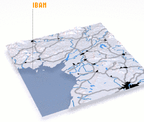 Places with similar names to Ibam, Korea, North ::
Disclaimer :: Information on this page comes without warranty of any kind |
||
|
Where is Ibam? Elevation and coordinates ::
Latitude (lat): 39°38'35"N Longitude (lon): 125°8'24"E
Elevation (approx.): 38m (map arrows pan, magnifying glasses zoom) |
||
|
Visiting Ibam? Hotel/Accommodation ::
Book a hotel in Ibam Travel Guide ::
rental cars ::
car rental offers GPS waypoint ::
download a GPX waypoint (PoI) of Ibam for your GPS receiver
|
||