|
search place name
|
||
Ilchabong-ni (Yanggang, Korea, North)Ilchabong-ni is a town in the Yanggang region of Korea, North. An overview map of the region around Ilchabong-ni is displayed below.
regional and 3d topo map of Ilchabong-ni, Korea, North ::
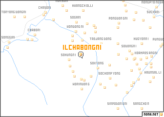
Nearby towns ::
Sŏhŭng-ni (2.2km west) //
Pugaebong (2.7km south west) //
Kaeunsŏng-ni (3.4km south west) //
Saengyang-ni (4.1km north) //
Sŏk-tong (3.5km south east) //
Namyang-dong (4.3km south) //
Sinipp'yŏng (4.4km south) //
Soamdong-ni (4.4km north) //
Taeyongbong-ni (4.8km south) //
Yonboktong-ni (5.0km south) //
Kwangamdong-ni (5.4km north) //
Taejang-dong (4.8km north east) //
Yongch'ŏl-li (5.9km north) //
Wŏndong-ni (6.3km north) //
Sogaeunsŏng (5.0km east) //
Yonggyo-ri (6.5km north) //
Wŏrin-dong (7.0km south) //
Ch'ŏnsangsu (6.6km south east) //
Kŏryong-ni (7.5km north) //
Soch'ŏnp'yŏng (6.7km south east) //
Sanggŏ-ri (7.8km north) //
Sinjŏl-li (8.0km north) //
Chungdurŭng-ni (6.3km east) //
Simp'odong-ni (7.7km south east) //
Sŏga-ri (8.4km north) //
Sangdurŭng-ni (7.0km north east) //
Kallyŏng-ni (8.4km south east) //
Sinhŭng-ni (9.4km north east) //
Hawŏndong-ni (10.1km north west) //
[all distances 'as the bird flies' and approximate] 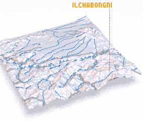 Places with similar names to Ilchabong-ni, Korea, North :: Disclaimer :: Information on this page comes without warranty of any kind |
||
|
Where is Ilchabong-ni? Elevation and coordinates ::
Latitude (lat): 41°14'9"N Longitude (lon): 127°49'36"E
Elevation (approx.): 1440m (map arrows pan, magnifying glasses zoom) |
||
|
Visiting Ilchabong-ni? Hotel/Accommodation ::
Book a hotel in Ilchabong-ni Travel Guide ::
rental cars ::
car rental offers GPS waypoint ::
download a GPX waypoint (PoI) of Ilchabong-ni for your GPS receiver
|
||