|
search place name
|
||
Kamdŏgi (Chagang, Korea, North)Kamdŏgi is a town in the Chagang region of Korea, North. An overview map of the region around Kamdŏgi is displayed below.
regional and 3d topo map of Kamdŏgi, Korea, North ::
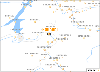
Nearby towns ::
Kujungyŏng-ni (1.9km north west) //
Naesamch'ŏn (1.9km north west) //
Yusam-ni (2.3km south) //
Ch'angp'yong (2.3km north west) //
Inp'ung-dong (2.4km north) //
Chŭng-dong (2.4km south) //
Soyusam-ni (2.2km south east) //
Chajang-ni (2.6km north) //
Sangmok-tong (2.5km north east) //
Pokho-dong (3.1km south) //
Kusŏng-dong (3.3km west) //
Chugam-dong (3.9km south east) //
Tonggokchang (5.3km south) //
Sinp'ung-ni (5.4km south) //
Simwŏn-dong (4.3km east) //
Tŏkkwibu (6.2km south) //
Soŭng-gol (6.6km north west) //
Unbong-nodongjagu (6.0km west) //
Chiktunji (8.0km south) //
Such'im-ni (8.9km north) //
Sodonggok (8.7km south) //
Yŏksu-ri (9.3km south) //
Taeyŏksu-dong (9.0km south west) //
Tonggu (9.0km north east) //
Kwiil-li (8.6km north east) //
Sangp'yŏng-ni (10.0km north east) //
Sang-dong (9.9km north east) //
[all distances 'as the bird flies' and approximate] 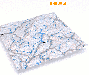 Places with similar names to Kamdŏgi, Korea, North ::
Disclaimer :: Information on this page comes without warranty of any kind |
||
|
Where is Kamdŏgi? Elevation and coordinates ::
Latitude (lat): 41°22'12"N Longitude (lon): 126°36'59"E
Elevation (approx.): 324m (map arrows pan, magnifying glasses zoom) |
||
|
Visiting Kamdŏgi? Hotel/Accommodation ::
Book a hotel in Kamdŏgi Travel Guide ::
rental cars ::
car rental offers GPS waypoint ::
download a GPX waypoint (PoI) of Kamdŏgi for your GPS receiver
|
||