|
search place name
|
||
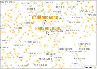
Kamsang-dong (Hwanghae, Korea, North)Kamsang-dong is a town in the Hwanghae region of Korea, North. An overview map of the region around Kamsang-dong is displayed below.
regional and 3d topo map of Kamsang-dong, Korea, North ::
Kamsang-dong airports ::
The nearest airport is GMP - Seoul Gimpo, located 77.8 km south of Kamsang-dong.
Other airports nearby include SSN - Seoul East Seoul Ab (93.3 km south), OSN - Osan Ab (130.6 km south), FNJ - Pyongyang Intl (147.9 km north west), SHO - Sokch'o Sokcho (154.5 km east), Nearby towns ::
Suin-dong (1.1km east) //
Wŏndang-dong (1.2km south west) //
Yangsa-ri (1.5km south) //
Kyŏrul-li (1.7km east) //
Tap-tong (2.0km north west) //
Kusŏk-tong (2.3km south) //
Segok-tong (2.0km north west) //
Haksal-li (2.3km north east) //
Changyang-dong (2.2km south west) //
Namsan-dong (2.7km north) //
Yŏnam-ni (2.9km north) //
Ch'ang-dong (2.7km north east) //
Tamnae-dong (3.0km north east) //
Chumak-tong (2.7km south west) //
Maegok-tong (3.0km south east) //
Sinjang-dong (2.6km east) //
Kyo-dong (3.0km north west) //
Changp'o-ri (3.2km south west) //
Wŏlch'on-dong (3.5km south east) //
Kwihyu-dong (4.2km north) //
Kamsang-dong (4.2km north) //
Nae-dong (4.3km south) //
Kwanghae-dong (4.3km south) //
Surenemik-kol (4.2km north west) //
Sin-ch'on (4.3km south east) //
Yongam-ni (4.1km south west) //
Kwirae-dong (4.0km north west) //
Tuhyŏn-dong (3.7km west) //
Wŏlsŏng-ni (4.7km north) //
[all distances 'as the bird flies' and approximate]  Places with similar names to Kamsang-dong, Korea, North ::
// Kamsaongtenga (BF)
// Kamsang-dong (KP)
// Kamsŏng-dong (KP)
// Kŭmsang-dong (KP)
// Kŭmsŏng-dong (KP)
// Kŭmsong-dong (KP)
// Kŭmsang-dong (KR)
// Komusan 2-dong (KP)
// Kŭmsŏng-dong (KP)
Disclaimer :: Information on this page comes without warranty of any kind |
||
|
Where is Kamsang-dong? Elevation and coordinates ::
Latitude (lat): 38°15'29"N Longitude (lon): 126°50'28"E
Elevation (approx.): 83m (map arrows pan, magnifying glasses zoom) |
||
|
Visiting Kamsang-dong? Hotel/Accommodation ::
Book a hotel in Kamsang-dong Travel Guide ::
rental cars ::
car rental offers GPS waypoint ::
download a GPX waypoint (PoI) of Kamsang-dong for your GPS receiver
|
||