|
search place name
|
||
Kimjŏngsug-ŭp (Yanggang, Korea, North)Kimjŏngsug-ŭp is a town in the Yanggang region of Korea, North. An overview map of the region around Kimjŏngsug-ŭp is displayed below.
regional and 3d topo map of Kimjŏngsug-ŭp, Korea, North ::
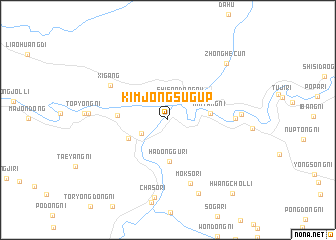
Nearby towns ::
Shisandaogou (2.6km north east) //
Changhang-ni (2.7km south west) //
Hadonggu-ri (4.6km south) //
Mint'ang-ni (3.6km east) //
Manhang-ni (3.9km south west) //
Kugalp'a (4.3km west) //
Xigang (6.2km north west) //
Moksŏ-ri (7.3km south) //
Sinsang-ni (5.7km east) //
Sonong-ni (6.2km east) //
Chasŏ-ri (8.7km south) //
Hwangch'ŏl-li (8.6km south) //
Kangha-ri (6.7km west) //
Zhonghecun (8.0km north east) //
Hwangch'ŏl-li (9.8km south east) //
[all distances 'as the bird flies' and approximate] 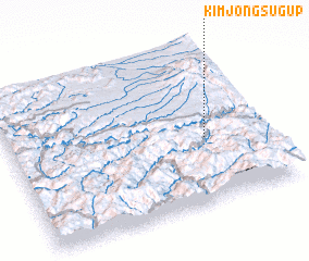 Places with similar names to Kimjŏngsug-ŭp, Korea, North :: Disclaimer :: Information on this page comes without warranty of any kind |
||
|
Where is Kimjŏngsug-ŭp? Elevation and coordinates ::
Latitude (lat): 41°24'30"N Longitude (lon): 127°45'53"E
Elevation (approx.): 575m (map arrows pan, magnifying glasses zoom) |
||
|
Visiting Kimjŏngsug-ŭp? Hotel/Accommodation ::
Book a hotel in Kimjŏngsug-ŭp Travel Guide ::
rental cars ::
car rental offers GPS waypoint ::
download a GPX waypoint (PoI) of Kimjŏngsug-ŭp for your GPS receiver
|
||