|
search place name
|
||
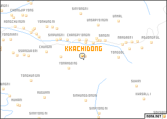
Kkach'i-dong (Yanggang, Korea, North)Kkach'i-dong is a town in the Yanggang region of Korea, North. An overview map of the region around Kkach'i-dong is displayed below.
regional and 3d topo map of Kkach'i-dong, Korea, North ::
Nearby towns ::
Namyang-dong (0.8km north) //
Yŏnam-dong (3.2km south west) //
Ch'angdong-ni (3.9km north) //
Chung-ni (4.1km north east) //
Yangnyu-ri (4.4km north) //
Ch'angp'yŏng-ni (4.4km north) //
Puyŏl-li (3.9km west) //
Sajang-ni (4.9km north east) //
Kŏnjang-ni (5.2km north east) //
Taet'ongbau (5.2km north west) //
Idŏgi (5.1km north east) //
Sang-ni (5.6km north east) //
Kanjindong-ni (6.1km north west) //
Sinp'ung-ni (6.3km north west) //
Tong-gol (6.0km east) //
Ch'ŭng-ni (6.5km west) //
Ŭnsap'yŏng-ni (8.2km north) //
Yanghŭng-ni (8.3km north west) //
Kwaesallyŏng-gol (7.4km north east) //
Nojŏng-ni (9.0km north west) //
Yŏnhŭng-ni (9.7km north west) //
Unmal (10.5km north east) //
Mugŭm-ni (10.8km south west) //
[all distances 'as the bird flies' and approximate]  Places with similar names to Kkach'i-dong, Korea, North ::
// Cushetunk (US)
// Kāsiadānga (BD)
// Kāsiādānga (BD)
// Kāsiādānga (BD)
// Kushādānga (BD)
// Koch'o-dong (KR)
// Kach'a-dong (KP)
// Kach'i-dong (KP)
// Kach'ŏ-dong (KP)
// Koch'i-dong (KP)
Disclaimer :: Information on this page comes without warranty of any kind |
||
|
Where is Kkach'i-dong? Elevation and coordinates ::
Latitude (lat): 41°1'35"N Longitude (lon): 128°27'44"E
Elevation (approx.): 1137m (map arrows pan, magnifying glasses zoom) |
||
|
Visiting Kkach'i-dong? Hotel/Accommodation ::
Book a hotel in Kkach'i-dong Travel Guide ::
rental cars ::
car rental offers GPS waypoint ::
download a GPX waypoint (PoI) of Kkach'i-dong for your GPS receiver
|
||