|
search place name
|
||
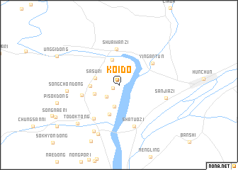
Koido (Hamgyŏng, Korea, North)Koido is a town in the Hamgyŏng region of Korea, North. An overview map of the region around Koido is displayed below.
regional and 3d topo map of Koido, Korea, North ::
Koido airports ::
The nearest airport is VVO - Vladivostok Knevichi, located 166.6 km east of Koido.
Nearby towns ::
Ido-dong (0.9km south west) //
Husu-dong (2.3km south west) //
Husŏng-ni (3.4km south) //
Sasu-ri (2.9km west) //
Tongsang (3.2km south west) //
Hunyung-ni (4.1km north) //
Hamyŏl-lodongjagu (3.3km west) //
Tongsŏm (4.8km south) //
Shuaiwanzi (5.7km north) //
Chungyŏng-ni (4.6km west) //
Ying'an (5.2km north east) //
Ying-an-t'un (5.2km north east) //
Saebyŏr-ŭp (6.1km south west) //
Shatuozi (6.8km south) //
Sanjiazi (5.9km east) //
Songch'ŏn-dong (6.1km west) //
Kŭmhŭi-dong (7.9km south) //
Yudasŏm-ni (8.1km south) //
Todŏk-tong (7.7km south west) //
Yangdong-ni (9.5km south) //
[all distances 'as the bird flies' and approximate]  Places with similar names to Koido, Korea, North ::
Disclaimer :: Information on this page comes without warranty of any kind |
||
|
Where is Koido? Elevation and coordinates ::
Latitude (lat): 42°51'32"N Longitude (lon): 130°14'18"E
Elevation (approx.): 31m (map arrows pan, magnifying glasses zoom) |
||
|
Visiting Koido? Hotel/Accommodation ::
Book a hotel in Koido Travel Guide ::
rental cars ::
car rental offers GPS waypoint ::
download a GPX waypoint (PoI) of Koido for your GPS receiver
|
||