|
search place name
|
||
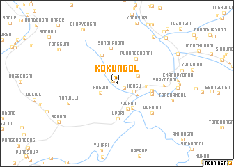
Kok'ŭn-gol (Yanggang, Korea, North)Kok'ŭn-gol is a town in the Yanggang region of Korea, North. An overview map of the region around Kok'ŭn-gol is displayed below.
regional and 3d topo map of Kok'ŭn-gol, Korea, North ::
Nearby towns ::
Sambong-ni (0.6km north west) //
Kohwa-ri (1.2km south east) //
Turim-ni (2.3km north) //
Tŏk-tong (2.2km north west) //
Koŏgu (2.4km south east) //
Koso-ri (2.5km south west) //
Kamak-kol (2.8km north east) //
Hagarim (3.1km south east) //
P'och'i-ri (4.3km south) //
Karim-ni (4.4km south east) //
Yongp'yŏng-ni (3.6km east) //
Puhŭngch'on-ni (4.6km north east) //
Sihwa-ri (4.9km north) //
Sŏngmang-ni (5.6km north) //
Up'o-ri (5.7km south) //
Imdong-ni (4.4km east) //
Tongch'ŏl-li (4.6km east) //
Paedŏgi (6.3km south east) //
Sap'yŏng-ni (5.7km east) //
Tanjil-li (6.7km south west) //
Sanghŭng-ni (8.6km north east) //
Ch'op'yŏng-ni (9.6km north west) //
Koam-ni (9.5km north east) //
Songam-ni (10.1km north east) //
Toha-ri (10.7km north east) //
[all distances 'as the bird flies' and approximate] 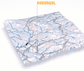 Places with similar names to Kok'ŭn-gol, Korea, North ::
// Quackenkill (US)
// Kakongolo (CD)
// Kakungula (CD)
// Kakungula (CD)
// Kakungula (CD)
// Kakungula (CD)
// Kikiongolo (CD)
// Kikungula (CD)
// Cukanggaleuh (ID)
// Kekunagolla (LK)
Disclaimer :: Information on this page comes without warranty of any kind |
||
|
Where is Kok'ŭn-gol? Elevation and coordinates ::
Latitude (lat): 41°2'50"N Longitude (lon): 128°12'20"E
Elevation (approx.): 885m (map arrows pan, magnifying glasses zoom) |
||
|
Visiting Kok'ŭn-gol? Hotel/Accommodation ::
Book a hotel in Kok'ŭn-gol Travel Guide ::
rental cars ::
car rental offers GPS waypoint ::
download a GPX waypoint (PoI) of Kok'ŭn-gol for your GPS receiver
|
||