|
search place name
|
||
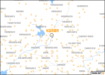
Kŭmam (P'yŏngan, Korea, North)Kŭmam is a town in the P'yŏngan region of Korea, North. An overview map of the region around Kŭmam is displayed below.
regional and 3d topo map of Kŭmam, Korea, North ::
Kŭmam airports ::
The nearest airport is FNJ - Pyongyang Intl, located 97.9 km south east of Kŭmam.
Nearby towns ::
Yul-tong (0.9km north) //
Sŏngjŏktong-Hadan (1.0km south) //
Sagi-dong (1.0km south) //
Yujŏng (1.2km west) //
Chwaisan-dong (1.3km south east) //
Poŭng-ni (1.8km north west) //
T'ohyŏn-dong (1.8km north west) //
Kabam (1.9km south west) //
Posŏng-ni (2.6km south west) //
Songu-dong (2.9km north east) //
Sim-dong (2.9km north east) //
T'ap-kol (3.2km north) //
Samsŏng-ni (3.3km north) //
Pultang-dong (3.3km south west) //
Omong-ni (3.3km south west) //
Paekhyŏl-li (3.1km south east) //
Nae-dong (3.0km west) //
Yonggyŏngdong-Hadan (4.0km north) //
T'ohyŏn-ni (3.2km west) //
Hwanghak-tong (3.2km west) //
Chungdan (3.8km north east) //
Sinsŏng-ni (3.9km south east) //
Wŏnp'yŏng (4.5km north) //
Nosang-dong (4.7km south) //
Tunch'ang-ni (4.1km north west) //
Sunyŏngch'ang-ni (4.1km north west) //
Tunch'ŏn-ni (4.1km north west) //
Isŏng-dong (4.9km south) //
Ansang-ni (5.0km south) //
[all distances 'as the bird flies' and approximate]  Places with similar names to Kŭmam, Korea, North ::
Disclaimer :: Information on this page comes without warranty of any kind |
||
|
Where is Kŭmam? Elevation and coordinates ::
Latitude (lat): 39°52'33"N Longitude (lon): 124°54'9"E
Elevation (approx.): 74m (map arrows pan, magnifying glasses zoom) |
||
|
Visiting Kŭmam? Hotel/Accommodation ::
Book a hotel in Kŭmam Travel Guide ::
rental cars ::
car rental offers GPS waypoint ::
download a GPX waypoint (PoI) of Kŭmam for your GPS receiver
|
||