|
search place name
|
||
Kwirak-kol (Hamgyŏng, Korea, North)Kwirak-kol is a town in the Hamgyŏng region of Korea, North. An overview map of the region around Kwirak-kol is displayed below.
regional and 3d topo map of Kwirak-kol, Korea, North ::
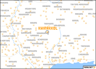
Nearby towns ::
Sŏhwadŏk (2.0km west) //
Nŏlbŭndol-ch'on (2.3km west) //
Kwirak-tong (3.1km south) //
Taeri-dong (3.3km north) //
Uch'ŏnggok (3.3km south west) //
Tojik-tong (4.0km south) //
Chikchŏ (4.5km south east) //
Son-gol (3.8km south east) //
Naktongp'o (5.0km south) //
Ch'ojang-dong (4.0km north west) //
Kyohyang-ni (4.9km south) //
Mundal-tong (4.3km south west) //
Kamjang-gol (4.3km north east) //
Chung-ch'on (5.1km south) //
Hyŏnam (4.6km south east) //
Hŭibang-dong (4.4km north west) //
Yup'o-dong (4.2km west) //
Chuŭi-ri (5.4km south) //
Ambang-dong (5.7km south) //
Pukkan-dong (5.3km south west) //
Sori-dong (6.1km north) //
Toranjae (5.2km south east) //
Sa-dong (5.6km north west) //
Sin'gi (6.3km south east) //
Ŏksŏdŏgi (6.2km north east) //
Sangnak-tong (5.3km west) //
Hangmyŏng-dong (6.5km south east) //
Hŏch'on-dong (6.0km south west) //
Chagŭn'gae (7.1km north) //
[all distances 'as the bird flies' and approximate] 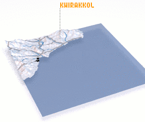 Places with similar names to Kwirak-kol, Korea, North ::
Disclaimer :: Information on this page comes without warranty of any kind |
||
|
Where is Kwirak-kol? Elevation and coordinates ::
Latitude (lat): 40°56'12"N Longitude (lon): 129°32'26"E
Elevation (approx.): 328m (map arrows pan, magnifying glasses zoom) |
||
|
Visiting Kwirak-kol? Hotel/Accommodation ::
Book a hotel in Kwirak-kol Travel Guide ::
rental cars ::
car rental offers GPS waypoint ::
download a GPX waypoint (PoI) of Kwirak-kol for your GPS receiver
|
||