|
search place name
|
||
Manam-gol (P'yŏngan, Korea, North)Manam-gol is a town in the P'yŏngan region of Korea, North. An overview map of the region around Manam-gol is displayed below.
regional and 3d topo map of Manam-gol, Korea, North ::

Manam-gol airports ::
The nearest airport is FNJ - Pyongyang Intl, located 103.5 km south west of Manam-gol.
Nearby towns ::
Hwasul-li (1.3km west) //
Songnae (2.2km north) //
Top'yŏng-ni (2.1km north east) //
Pongdŏng-ni (2.4km south east) //
Samwŏlganggŏri (2.2km north west) //
Tolmol (2.6km north east) //
Handae-dong (2.8km north) //
Yŏngwŏn-ŭp (3.1km south) //
Tolmoru (2.9km north east) //
Sogok (2.7km east) //
Yonghŭng-dong (3.0km north west) //
Ch'ildami (3.5km north west) //
Kwanp'yŏng (3.9km north) //
Masan-gol (3.4km north east) //
Sungnye-dong (3.2km west) //
P'ot'an (4.3km south) //
Munhŭng-ni (4.5km south) //
Namsŏk-kol (3.8km north west) //
Mun'gong-ni (4.7km south) //
Sangch'am (4.5km south west) //
Songhang-ni (4.8km south east) //
Ibong-dong (4.0km west) //
Songp'yŏng-ni (5.1km north) //
P'ungjŏl-li (4.2km west) //
T'apkŏri (4.9km south east) //
Sil-li (5.0km south west) //
Yongsŏng-ni (5.6km south) //
Sindŏng-ni (5.9km south) //
Hach'am (5.4km south west) //
[all distances 'as the bird flies' and approximate] 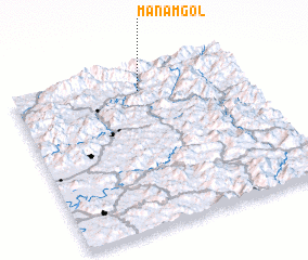 Places with similar names to Manam-gol, Korea, North ::
// Munumekule (ZM)
// Minmak-kol (KP)
Disclaimer :: Information on this page comes without warranty of any kind |
||
|
Where is Manam-gol? Elevation and coordinates ::
Latitude (lat): 39°51'43"N Longitude (lon): 126°32'52"E
Elevation (approx.): 300m (map arrows pan, magnifying glasses zoom) |
||
|
Visiting Manam-gol? Hotel/Accommodation ::
Book a hotel in Manam-gol Travel Guide ::
rental cars ::
car rental offers GPS waypoint ::
download a GPX waypoint (PoI) of Manam-gol for your GPS receiver
|
||