|
search place name
|
||
Manho-dong (Hamgyŏng, Korea, North)Manho-dong is a town in the Hamgyŏng region of Korea, North. An overview map of the region around Manho-dong is displayed below.
regional and 3d topo map of Manho-dong, Korea, North ::
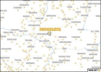
Nearby towns ::
Ujang-dong (1.4km east) //
Yongsan (1.9km south west) //
Malp'yŏng (2.3km south east) //
Myŏngch'ŏn-ŭp (2.7km south) //
Yongho-dong (2.2km west) //
Manho-ri (2.6km south east) //
Ullyong-ni (3.3km south west) //
Paeryŏng-dong (3.4km south east) //
Yongam-nodongjagu (2.8km west) //
Injŏltŏgi (3.9km south) //
Posu-gol (3.7km east) //
Chidŏgi (4.4km south west) //
Hwanggong-ni (4.9km south) //
T'ŏ-gol (5.1km south) //
Koch'am-ni (4.0km west) //
Sosan (5.5km north west) //
Kanp'o (5.9km north) //
Kukhwa-dong (4.6km west) //
Songp'yŏng (5.4km south east) //
Chaedŏgi (6.3km north) //
Ch'anghyŏp (6.3km south) //
Paekpauap'e (5.3km south east) //
Yŏngdŏk (5.4km north east) //
Sang-dong (6.6km north) //
Yŏndae-dong (5.5km north west) //
Tŏm-gol (5.4km north west) //
Sohyŏn (6.4km north west) //
Kŏmun-dong (7.0km south) //
Tŏngnyangp'o (5.3km west) //
[all distances 'as the bird flies' and approximate] 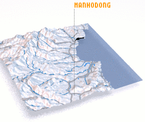 Places with similar names to Manho-dong, Korea, North ::
Disclaimer :: Information on this page comes without warranty of any kind |
||
|
Where is Manho-dong? Elevation and coordinates ::
Latitude (lat): 41°5'41"N Longitude (lon): 129°25'54"E
Elevation (approx.): 397m (map arrows pan, magnifying glasses zoom) |
||
|
Visiting Manho-dong? Hotel/Accommodation ::
Book a hotel in Manho-dong Travel Guide ::
rental cars ::
car rental offers GPS waypoint ::
download a GPX waypoint (PoI) of Manho-dong for your GPS receiver
|
||