|
search place name
|
||
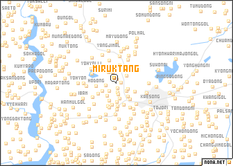
Mirŭktang (Kaesŏng, Korea, North)Mirŭktang is a town in the Kaesŏng region of Korea, North. An overview map of the region around Mirŭktang is displayed below.
regional and 3d topo map of Mirŭktang, Korea, North ::
Mirŭktang airports ::
The nearest airport is GMP - Seoul Gimpo, located 54.9 km south east of Mirŭktang.
Other airports nearby include SSN - Seoul East Seoul Ab (81.4 km south east), OSN - Osan Ab (110.9 km south east), FNJ - Pyongyang Intl (154.3 km north west), YEC - Yechon Yecheon (223.3 km south east), Nearby towns ::
Chema-dong (0.6km north) //
Ch'ŏnghak-tong (0.6km east) //
Ch'illŭng-dong (0.8km south) //
Haesŏl-li (1.6km south) //
Paenamuk-kol (1.6km south west) //
Kongnyŏng-ni (1.4km west) //
T'aejorŭng-dong (1.8km south) //
Non-gol (1.8km north) //
Pongnyŏng-dong (1.7km south east) //
Wŏllo-gol (1.8km north east) //
Pŏmgŭn-dong (1.8km south east) //
Pongmyŏng-gol (2.0km north west) //
Chak-tong (2.4km south west) //
Korŭng-dong (2.6km south) //
Haean-gol (2.2km south west) //
Yŏrŭm-ni (2.6km south east) //
Tok-kol (2.9km north) //
Tumun-dong (3.0km south) //
Myŏngnŭng-dong (3.1km south) //
Sajik-tong (2.8km south east) //
Ho-dong (2.7km west) //
Ojŏngmun (3.1km south east) //
Chŏngnŭng (2.9km south west) //
Ami-gol (3.6km south) //
P'yŏng-dong (3.6km south) //
Isammol (3.6km south) //
Yŏllŭng-ni (3.8km south) //
Ich'un-gol (3.7km north) //
Kamnŭng-dong (3.3km north west) //
[all distances 'as the bird flies' and approximate] 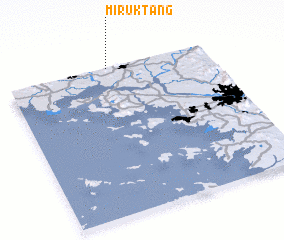 Places with similar names to Mirŭktang, Korea, North ::
// Maru Gahtawng (MM)
// Maru-gahtawng (MM)
// Markitanka (RU)
// Muarakedang (ID)
// Mirŏk-tong (KP)
// Mirŭk-tong (KP)
// Mirŭk-tong (KP)
// Mirŭk-tong (KP)
// Mirŭk-tong (KP)
// Maerak-tong (KR)
Disclaimer :: Information on this page comes without warranty of any kind |
||
|
Where is Mirŭktang? Elevation and coordinates ::
Latitude (lat): 37°59'54"N Longitude (lon): 126°30'22"E
Elevation (approx.): 76m (map arrows pan, magnifying glasses zoom) |
||
|
Visiting Mirŭktang? Hotel/Accommodation ::
Book a hotel in Mirŭktang Travel Guide ::
rental cars ::
car rental offers GPS waypoint ::
download a GPX waypoint (PoI) of Mirŭktang for your GPS receiver
|
||