|
search place name
|
||
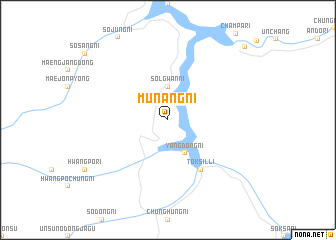
Munang-ni (Korea, North)Munang-ni is a town in Korea, North. An overview map of the region around Munang-ni is displayed below.
regional and 3d topo map of Munang-ni, Korea, North ::
Munang-ni airports ::
The nearest airport is FNJ - Pyongyang Intl, located 215.2 km south west of Munang-ni.
Nearby towns ::
Sŏlgwan-ni (3.7km north) //
Yangdŏng-ni (4.0km south) //
Tŏksil-li (6.2km south east) //
Sojang (10.4km north east) //
[all distances 'as the bird flies' and approximate]  Places with similar names to Munang-ni, Korea, North ::
// Mān Na-ngan (MM)
// Monaunggin (MM)
// Manangon (PH)
// Manioñgon (PH)
// Manuañgan (PH)
// Manangona (MG)
// Minoungouni (KM)
// Munang-ni (KP)
// Munong-ni (KP)
// Munong-ni (KP)
Disclaimer :: Information on this page comes without warranty of any kind |
||
|
Where is Munang-ni? Elevation and coordinates ::
Latitude (lat): 40°47'0"N Longitude (lon): 127°10'0"E
Elevation (approx.): 1035m (map arrows pan, magnifying glasses zoom) |
||
|
Visiting Munang-ni? Hotel/Accommodation ::
Book a hotel in Munang-ni Travel Guide ::
rental cars ::
car rental offers GPS waypoint ::
download a GPX waypoint (PoI) of Munang-ni for your GPS receiver
|
||