|
search place name
|
||
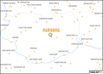
Nŭpsang (Korea, North)Nŭpsang is a town in Korea, North. An overview map of the region around Nŭpsang is displayed below.
regional and 3d topo map of Nŭpsang, Korea, North ::
Nŭpsang airports ::
The nearest airport is FNJ - Pyongyang Intl, located 121.3 km west of Nŭpsang.
Other airports nearby include SHO - Sokch'o Sokcho (211.7 km south east), KAG - Kangnung Gangneung (264.3 km south east), Nearby towns ::
Kŭm-ch'on (1.4km east) //
P'ungnyu-dong (5.7km north) //
Simch'ŏn (7.4km south) //
Yongch'ŏl-li (5.8km east) //
Kangbyŏn (7.2km south east) //
Iryangdŏk (7.0km north west) //
Kaa-gol (7.1km south west) //
T'aehwa-ri (7.9km north) //
Sang-dong (8.8km north) //
Hyangbong-ni (8.4km north east) //
Koŭp-tong (9.3km south west) //
[all distances 'as the bird flies' and approximate]  Places with similar names to Nŭpsang, Korea, North ::
// Napsong (PH)
Disclaimer :: Information on this page comes without warranty of any kind |
||
|
Where is Nŭpsang? Elevation and coordinates ::
Latitude (lat): 39°35'0"N Longitude (lon): 127°0'0"E
Elevation (approx.): 213m (map arrows pan, magnifying glasses zoom) |
||
|
Visiting Nŭpsang? Hotel/Accommodation ::
Book a hotel in Nŭpsang Travel Guide ::
rental cars ::
car rental offers GPS waypoint ::
download a GPX waypoint (PoI) of Nŭpsang for your GPS receiver
|
||